Category:Maps showing 1st-century BC history
Jump to navigation
Jump to search
| Preceded by: 2nd century BC maps |
1st century BC maps 100 BC-1 BC |
Succeeded by: 1st century maps |
Subcategories
This category has the following 12 subcategories, out of 12 total.
A
B
- Battle of Aisne (5 F)
- Battle of Morbihan (15 F)
- Battle of Ochsenfeld (4 F)
- Battle of the Sabis (6 F)
M
R
- Maps of Roman Syria (28 F)
Media in category "Maps showing 1st-century BC history"
The following 106 files are in this category, out of 106 total.
-
 MACCOUN(1899) p153 65 B.C.- 48 B.C. PALESTINE UNDER THE ROMANS, POMPEY.jpg 2,002 × 3,598; 2.93 MB
-
 465 of 'A History of Rome to the death of Cæsar' (11238694426).jpg 2,016 × 1,250; 578 KB
-
 578 of 'A History of Rome to the death of Cæsar' (11236282793).jpg 1,250 × 2,026; 519 KB
-
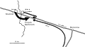
 Tigranakert (Tigranocerta) battle in 69 BC (Armenian).png 700 × 434; 53 KB
-
 Alter Orient 0100BC-es.svg 2,102 × 1,510; 3.84 MB
-
 Alter Orient 0100BC.svg 2,102 × 1,510; 4.77 MB
-
 Alter Orient+Persien 100BC.svg 3,100 × 1,960; 14.78 MB
-
 Anatolia 264.jpg 823 × 513; 191 KB
-
 Aquitania 002.png 568 × 590; 256 KB
-
 Armenian Empire 80 BC.png 1,084 × 705; 22 KB
-
 Asia 100bc.jpg 2,053 × 1,196; 760 KB
-
 Asia minor Mithridates retouched.jpg 1,043 × 576; 321 KB
-
 Asia minor Mithridates.jpg 1,043 × 577; 457 KB
-
 AsiamenorAntesDel90ACSinColores.svg 3,274 × 1,793; 630 KB
-
 Bellum mithridaticum 85aC.png 1,901 × 1,697; 2.91 MB
-
 Bellum piraticum Pompeii 67 aC.png 2,046 × 1,496; 4.72 MB
-
 Bellum-Asturicum-Cantabricum.png 1,147 × 686; 58 KB
-
 Bitwa pod Zelą.svg 488 × 1,052; 73 KB
-
 Calcedonia-Bisanzio 74aC png.PNG 1,036 × 899; 53 KB
-
 Cantabria prerromana.svg 992 × 694; 3.05 MB
-
 Cantabros.png 763 × 519; 141 KB
-
 Cesare Ginevra 58 aC.png 1,209 × 1,018; 278 KB
-
 Cheronea 86aC.png 1,606 × 1,383; 122 KB
-
 Dacia 82 BC heb.png 650 × 544; 349 KB
-
 Dacia 82 BC.png 306 × 246; 53 KB
-
 Dacia around 60-44 BC during Burebista, including campaigns - Czech.png 2,901 × 1,866; 1.5 MB
-
 Dacia around 60-44 BC during Burebista, including campaigns - French.png 2,901 × 1,866; 1.35 MB
-
 Dacia around 60-44 BC during Burebista, including campaigns - Italian.png 2,901 × 1,866; 1.48 MB
-
 Drususfeldzuege 10-9-v-Chr.jpg 2,560 × 1,920; 1.35 MB
-
 Drususfeldzuege 12-11-v-Chr.jpg 2,560 × 1,920; 1.33 MB
-
 East-Hem 050bc.jpg 3,240 × 1,903; 722 KB
-
 East-Hem 100bc.jpg 3,240 × 1,903; 737 KB
-
 Europe -50.png 1,704 × 1,181; 1.99 MB
-
 Europe -58-bw.png 1,704 × 1,181; 835 KB
-
 Gallia Cesare 53 aC.png 1,318 × 1,559; 1.14 MB
-
 Gallia Cesare 56 aC.png 1,318 × 1,559; 911 KB
-
 Hpa-tigranakertbattle69.gif 700 × 418; 31 KB
-
 Impero romano sotto Ottaviano Augusto 30aC - 6dC.jpg 1,704 × 1,181; 1.27 MB
-
 Jiankun map.jpg 1,225 × 816; 66 KB
-
 Kleinasien II.jpg 3,046 × 1,690; 933 KB
-
 Kleinasien III.jpg 3,038 × 1,706; 891 KB
-
 Le campagne militari di Cesare (61–45 a.C.).jpg 3,106 × 1,815; 473 KB
-
 Map de Bello Gallico Liber1.png 787 × 799; 125 KB
-
 Map de Bello Gallico Liber2.png 787 × 799; 141 KB
-
 Map de Bello Gallico Liber6.png 787 × 799; 129 KB
-
 Map Gallia Tribes Towns-es.svg 1,450 × 1,460; 2.37 MB
-
 Map Gallia Tribes Towns.png 787 × 799; 352 KB
-
 Map of the Armenian Empire of Tigranes (English).svg 512 × 506; 61 KB
-
 Map Philippi campaign 42 BC-en.svg 2,250 × 913; 513 KB
-
 Map Philippi campaign 42 BC-es.svg 1,920 × 779; 682 KB
-
 Map Philippi campaign 42 BC-fr.svg 1,800 × 730; 550 KB
-
 Map Philippi campaign 42 BC-it.svg 1,800 × 730; 528 KB
-
 Map Philippi campaign 42 BC-zh.svg 2,250 × 913; 631 KB
-
 Map-de-Bello-Gallico-Liber3.png 787 × 799; 121 KB
-
 Map-de-Bello-Gallico-Liber4.png 787 × 799; 125 KB
-
 Map-de-Bello-Gallico-Liber5.png 787 × 799; 126 KB
-
 Maps of the Armenian Empire of Tigranes-es.svg 1,975 × 1,958; 640 KB
-
 Maps of the Armenian Empire of Tigranes-he.svg 512 × 506; 38 KB
-
 Maps of the Armenian Empire of Tigranes-pt.svg 512 × 506; 50 KB
-
 Maps of the Armenian Empire of Tigranes.gif 673 × 669; 56 KB
-
 MapTheatreofPompey.jpg 2,472 × 2,121; 1.31 MB
-
 Mithridates in 88aC.png 2,425 × 1,581; 3.32 MB
-
 Mithridates in 89aC.png 2,425 × 1,581; 3.32 MB
-
 Mutinan taistelu-pt.svg 812 × 450; 41 KB
-
 Mutinan taistelu.svg 812 × 450; 41 KB
-
 Namnetes.jpg 787 × 799; 1.42 MB
-
 Norte de hispania siglo I adeC.JPG 1,990 × 1,573; 198 KB
-
 Orchomenos 86aC png.PNG 1,606 × 1,383; 118 KB
-
 Pompeius wars map (Ukrainian).png 2,391 × 860; 445 KB
-
 PonticKingdom.png 1,551 × 1,296; 265 KB
-
 Region of the Wars with Mithridates.png 718 × 421; 192 KB
-
 Roma in Oriente 62aC.png 2,425 × 1,581; 3.59 MB
-
 Roma in Oriente 63aC.png 2,425 × 1,581; 3.6 MB
-
 Roma in Oriente 64aC.png 2,425 × 1,581; 3.59 MB
-
 Roma in Oriente 65aC.png 2,425 × 1,581; 3.6 MB
-
 Roma in Oriente 66aC.png 2,425 × 1,581; 3.59 MB
-
 Roma in Oriente 67aC.png 2,425 × 1,581; 3.54 MB
-
 Roma in Oriente 68aC.png 2,425 × 1,581; 3.52 MB
-
 Roma in Oriente 74aC.png 2,425 × 1,581; 3.47 MB
-
 Roma in Oriente 92aC.png 2,425 × 1,581; 3.31 MB
-
 Roma nel 31 aC.png 2,520 × 2,802; 1.12 MB
-
 Roman asia, eve of First Mithridatic war.svg 1,256 × 609; 1.26 MB
-
 Roman-Empire-36BC.png 1,971 × 1,153; 670 KB
-
 Roman-Empire-39BC-bg-pt.svg 1,842 × 834; 127 KB
-
 Roman-Empire-39BC-bg.png 2,450 × 1,320; 495 KB
-
 Roman-Empire-39BC-sm.png 1,971 × 1,153; 612 KB
-
 Roman-Empire-42BC.png 1,971 × 1,153; 666 KB
-
 Roman-Empire-43BC.png 1,976 × 1,150; 659 KB
-
 SakastanMap.jpg 1,356 × 1,109; 258 KB
-
 Scythia-Parthia 100 BC-ar.png 550 × 350; 280 KB
-
 Scythia-Parthia 100 BC-es.svg 865 × 522; 2.16 MB
-
 Scythia-Parthia 100 BC-pt.svg 865 × 522; 2.11 MB
-
 Scythia-Parthia 100 BC.png 550 × 350; 303 KB
-
 Scythosarmlang.jpg 752 × 590; 49 KB
-
 Syria under the Seleucids 87 BC.svg 1,014 × 944; 2.58 MB
-
 Syria under the Seleucids 92 BC-es.svg 1,014 × 944; 768 KB
-
 Syria under the Seleucids 92 BC.svg 1,014 × 944; 2.58 MB
-
 Syria under the Seleucids 95 BC-es.svg 1,014 × 944; 783 KB
-
 Syria under the Seleucids 95 BC.svg 1,014 × 944; 2.6 MB
-
 Transcaucasia 2nd BC-ar.png 982 × 772; 445 KB
-
 Transcaucasia 2nd BC.jpg 982 × 772; 232 KB
-
 Various races of Central Asia in The 1st century BC.(ja).png 567 × 470; 532 KB
-
 Western Regions 1st century (ja).png 680 × 425; 592 KB
-
 Western Regions 1st century BC (ja).png 680 × 425; 633 KB
-
 Western Regions 3rd century (ja).png 680 × 425; 593 KB
-
 Western Regions in The 1st century BC (ja).png 680 × 425; 591 KB
_p153_65_B.C.-_48_B.C._PALESTINE_UNDER_THE_ROMANS,_POMPEY.jpg)
.jpg)
.jpg)
_battle_in_69_BC_(Armenian).png)


.jpg)


.svg)


.png)
.png)
.png)
.png)
.png)
.png)