Category:Maps showing 1967
Jump to navigation
Jump to search
| ← 1960 1961 1962 1963 1964 1965 1966 1967 1968 1969→ |
English: Maps showing the year 1967 (i.e. history maps)
See also category: 1967 maps. and 1960s maps for old maps created in this time.
See also category: 1967 maps. and 1960s maps for old maps created in this time.
Subcategories
This category has only the following subcategory.
Media in category "Maps showing 1967"
The following 4 files are in this category, out of 4 total.
-
 Crosne-VSG Modification territoriale (6-10-1967).svg 479 × 406; 2.12 MB
-
 Flag map of Israel 1967.png 400 × 600; 9 KB
-
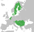 Group of Nine (Ten) - 1967.png 1,028 × 978; 39 KB
-
 Map of French Somaliland independence referendum, 1967.png 1,927 × 1,923; 300 KB
.svg)

_-_1967.png)
