Category:Maps showing 1954
Jump to navigation
Jump to search
| ← 1950 1951 1952 1953 1954 1955 1956 1957 1958 1959→ |
English: Maps showing the year 1954 (i.e. history maps)
See also category: 1954 maps. and 1950s maps for more maps showing this year usually created not long after the given year.
See also category: 1954 maps. and 1950s maps for more maps showing this year usually created not long after the given year.
Subcategories
This category has only the following subcategory.
Media in category "Maps showing 1954"
The following 2 files are in this category, out of 2 total.
-
Evolution of United States standard time zone boundaries.webm 29 s, 3,507 × 2,480; 4.58 MB
-
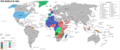 World map 1954.png 3,005 × 1,247; 331 KB
