Category:Maps showing 1914
Jump to navigation
Jump to search
| ← 1910 1911 1912 1913 1914 1915 1916 1917 1918 1919→ |
English: Maps showing the year 1914 (i.e. history maps)
See also category: 1914 maps. and 1910s maps for old maps created in this time.
See also category: 1914 maps. and 1910s maps for old maps created in this time.
Subcategories
This category has only the following subcategory.
Media in category "Maps showing 1914"
The following 45 files are in this category, out of 45 total.
-
 1914 Yılında Osmanlı İmparatorluğu'nda Kara ve Demiryolu Ağı Durumu.jpg 1,541 × 1,096; 411 KB
-
 1914 Екатеринославская губерния.jpg 1,571 × 1,181; 267 KB
-
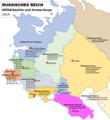 1914-Militärbezirke Russland-03.png 761 × 828; 114 KB
-
 Austro-Hungarian Monarchy (1914).svg 450 × 456; 456 KB
-
 BritishEmpire1914.png 8,192 × 4,096; 511 KB
-
 Colonies in Africa in 1914.jpg 2,203 × 2,080; 515 KB
-
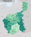 CongressPoland1914Map.png 2,125 × 2,524; 1.13 MB
-
 Europa 1914-es.svg 1,363 × 1,363; 490 KB
-
 Europa 1914.svg 1,363 × 1,363; 353 KB
-
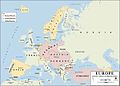
 Europe 1914 (pre-WW1), coloured and labelled-es.svg 450 × 456; 661 KB
-
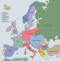 Europe 1914 (pre-WW1), coloured and labelled.svg 450 × 456; 555 KB
-
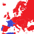 Europe 1914 monarchies versus republics.png 2,000 × 2,027; 353 KB
-
 Europe 1914.jpg 1,198 × 863; 110 KB
-
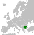
 Flag map of Bulgaria (1914).svg 1,100 × 871; 22 KB
-
 Flag Map of the world (1914 handrawn).png 1,500 × 636; 73 KB
-
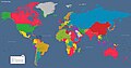
 Flag Map of The World (1914).png 4,974 × 2,519; 821 KB
-
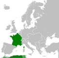 French Republic 1914.svg 928 × 911; 400 KB
-
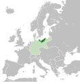
 German Empire 1914.svg 450 × 456; 466 KB
-
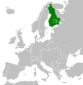 Grand Principality of Finland (1914).svg 450 × 456; 456 KB
-
 Indian Empire in 1914 orthographic.png 550 × 550; 79 KB
-
 Indian Empire in 1914.png 1,425 × 625; 29 KB
-
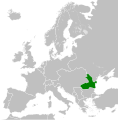
 Kingdom of Bulgaria (1914).svg 450 × 456; 456 KB
-
 Kingdom of Greece (1914).svg 450 × 456; 456 KB
-
 Kingdom of Italy (1914).svg 450 × 456; 468 KB
-
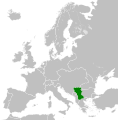
 Kingdom of Montenegro (1914).svg 450 × 456; 441 KB
-
 Kingdom of Romania (1914).svg 450 × 456; 441 KB
-
 Kingdom of Serbia (1914).svg 450 × 456; 456 KB
-
 Localisation Haut-Sénégal et Niger 1914.svg 531 × 443; 1.71 MB
-
 Map Europe alliances 1914-bg.svg 1,002 × 593; 73 KB
-
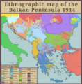
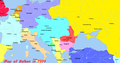 Map of the balkan region in 1914.png 1,121 × 585; 59 KB
-
 Map of the World (1914)-1.png 4,974 × 2,519; 325 KB
-
 Map of the World (1914).PNG 1,500 × 830; 92 KB
-
 Nigeria1914gbr.jpg 1,153 × 957; 390 KB
-
 Pomerania 1914.svg 450 × 456; 518 KB
-
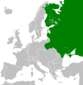 Russian Empire (1914).svg 450 × 456; 644 KB
-
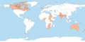
 Russian Empire (orthographic projection).svg 541 × 541; 393 KB
-
 Silésie Autrichienne au sein de la double monarchie en 1914-es.svg 3,507 × 2,657; 1.13 MB
-
 Silésie Autrichienne au sein de la double monarchie en 1914.svg 3,507 × 2,657; 691 KB
-

-
 UK 1914.svg 450 × 456; 477 KB
-
 Untitled27 Restored 20240217195451.png 4,960 × 5,060; 5.01 MB
-
 Wolrd Map 1914.png 1,025 × 558; 65 KB
-
 World map 1914.jpg 5,000 × 2,605; 829 KB
-
 Եվրոպան 1914 թվական.png 1,821 × 1,149; 105 KB
-
 Ⲉⲩⲣⲱⲡⲏ ϩⲉⲛ 1914.png 2,000 × 1,184; 313 KB


.svg)


,_coloured_and_labelled-es.svg)
,_coloured_and_labelled.svg)


.svg)
.png)
.png)


.svg)


.svg)
.svg)
.svg)
.svg)
.svg)
.svg)


-1.png)
.PNG)


.svg)
.svg)


_(14594568359).jpg)


