Category:Maps showing 1400
Jump to navigation
Jump to search
| 1400 1402 1404 1405 → |
English: Maps showing the year 1400 (i.e. history maps)
See also category: 1400 maps. and 1400s maps for old maps created in this time.
See also category: 1400 maps. and 1400s maps for old maps created in this time.
Media in category "Maps showing 1400"
The following 15 files are in this category, out of 15 total.
-
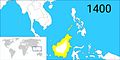 Brunei territories (1400).jpg 1,920 × 960; 398 KB
-
 Brunei territories (1400).png 1,920 × 960; 282 KB
-
 CoronadeCastilla1400.jpg 738 × 542; 188 KB
-
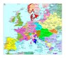 Europe en 1400.pdf 1,752 × 1,239; 513 KB
-
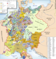 HRR 1400.png 3,715 × 3,966; 4.11 MB
-
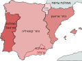 Iberian Kingdoms in 1400-he.svg 738 × 542; 987 KB
-
 Iberian Kingdoms in 1400.svg 738 × 542; 971 KB
-
 Modern history; Europe (1904) (14579066890).jpg 3,040 × 2,072; 1.88 MB
-
 Niedersachsen um 1400.jpg 1,948 × 1,644; 487 KB
-
 Niedersachsen um 1400.png 1,948 × 1,644; 3.38 MB
-
 South India in AD 1400.jpg 346 × 291; 96 KB
-
 Venice1400.png 647 × 563; 195 KB
-
 Venice1400.svg 647 × 562; 152 KB
-
 Wustrau Brandenburg-Preußen Museum-Königreiche 4006.jpg 3,389 × 3,587; 7.73 MB
-
 مملكة هرمز.png 1,530 × 1,645; 423 KB
.jpg)
.png)


_(14579066890).jpg)


