Category:Maps of weather in 1991
Jump to navigation
Jump to search
Please sort by date, if specified
[[Maps of weather in 1991|MMDDhhmm]](in UTC)- take
*for complete year,MM-MMorMMDD-DDfor spans
Media in category "Maps of weather in 1991"
The following 9 files are in this category, out of 9 total.
-
 Tephra fall from 1991 eruption of Mt Pinatubo fr.gif 600 × 425; 27 KB
-
 Tephra fall from 1991 eruption of Mt Pinatubo.gif 600 × 425; 25 KB
-
 Iraq-gwi-map.jpg 242 × 229; 37 KB
-
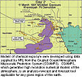
 TOMS AI Jun16 91.gif 800 × 590; 129 KB
-
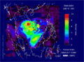
 TOMS SO2 Jun17 91.gif 800 × 590; 64 KB
-
 Halstmpk.gif 800 × 540; 181 KB
-
 WV 09 April 1991 Derecho - 1.png 1,075 × 576; 111 KB
-
 WV 09 April 1991 Derecho - 2.png 1,079 × 578; 113 KB
-
 WV 09 April 1991 Derecho - 3.png 1,073 × 574; 114 KB


