Category:Maps of weather and climate of Africa
Jump to navigation
Jump to search
Temperate regions: North America · South America · Africa · Europe · Asia · Oceania – Polar regions: Antarctica · Arctic – Other regions:
Subcategories
This category has the following 59 subcategories, out of 59 total.
Media in category "Maps of weather and climate of Africa"
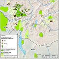
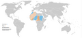
The following 64 files are in this category, out of 64 total.
-
-
 36 of 'Le Sahara. ... Avec 36 cartes et gravures, etc' (11304095203).jpg 1,322 × 856; 254 KB
-

-
 Africa (1878) (14773262961).jpg 2,132 × 3,594; 1.3 MB
-
 Africa - Environa naturala.png 675 × 728; 186 KB
-
 Africa 1971 2000 mean temperature.png 1,082 × 1,183; 710 KB
-
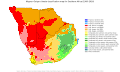
 Africa Climate Zones (5485510795).jpg 2,407 × 3,174; 768 KB
-
 Africa fldas 2023dec surface soil percent saturation.jpg 720 × 750; 374 KB
-
 Africa map of Köppen climate classification.svg 1,900 × 1,900; 899 KB
-
 Africa Ocean Currents Map-sr.svg 1,000 × 1,000; 371 KB
-
 Africa Pressure Map January.svg 1,000 × 1,000; 375 KB
-
 Africa Pressure Map July.svg 1,000 × 1,000; 427 KB
-
 Africa Rainfalls map 1913.jpg 2,000 × 1,211; 2.52 MB
-
 Africa Temperature Map-sr.svg 2,000 × 1,000; 763 KB
-
 Africa temperature-es.png 2,036 × 2,747; 1.7 MB
-
 Africa temperature.png 2,036 × 2,747; 2.36 MB
-
 African geo map.JPG 629 × 790; 45 KB
-
 AfricaRain TRM 2007264.jpg 540 × 600; 132 KB
-
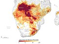
 AfriqueStressHydrique2025.jpg 612 × 526; 79 KB
-
 Agulhas Current NLOM .png 792 × 494; 203 KB
-
 An atlas of commercial geography (1913) (14758455926).jpg 2,326 × 2,878; 1.61 MB
-
 Biomas de África.PNG 404 × 347; 22 KB
-
 Botswana - Clima (classificacion de Koppen).png 605 × 530; 44 KB
-
 Botswana map of Köppen climate classification.svg 1,900 × 1,900; 55 KB
-
 Clima african segon la classificacion de Koppen.png 1,503 × 1,572; 474 KB
-
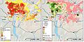
 Climate Zones, Observed Climate Data 1976 - 2000, Africa (7242983868).jpg 2,467 × 3,141; 869 KB
-
 Coastal low.jpg 9,950 × 6,800; 3.64 MB
-
 ECDM 20210129 Africa Drought 2010-2019.pdf 1,625 × 1,125; 610 KB
-
 ECDM 20220901 FL Niger.pdf 2,479 × 1,754; 775 KB
-
 Greening Sahel 1982-1999.jpg 949 × 365; 64 KB
-
 IEA'The Oil and Gas Industry in Net Zero Transitions'-Figure 4.3.png 821 × 577; 174 KB
-
 Koppen-Geiger Map Africa future crop650x550.svg 900 × 750; 346 KB
-
 Koppen-Geiger Map Africa future.svg 1,435 × 850; 3.43 MB
-
 Koppen-Geiger Map Africa present crop650x550.svg 900 × 750; 410 KB
-
 Koppen-Geiger Map Africa present.svg 1,435 × 850; 2.4 MB
-
 Koppen-Geiger Map Eastern Africa future.svg 1,329 × 850; 2.17 MB
-
 Koppen-Geiger Map Eastern Africa present.svg 1,329 × 850; 2.46 MB
-
 Koppen-Geiger Map Middle Africa future.svg 1,318 × 850; 1.2 MB
-
 Koppen-Geiger Map Middle Africa present.svg 1,318 × 850; 1.31 MB
-
 Koppen-Geiger Map Northern Africa future.svg 1,691 × 850; 1.35 MB
-
 Koppen-Geiger Map Northern Africa present.svg 1,691 × 850; 1.4 MB
-
 Koppen-Geiger Map Southern Africa future.svg 1,420 × 850; 1.17 MB
-
 Koppen-Geiger Map Southern Africa present.svg 1,420 × 850; 1.25 MB
-
 Koppen-Geiger Map Western Africa future.svg 1,553 × 850; 1.75 MB
-
 Koppen-Geiger Map Western Africa present.svg 1,553 × 850; 1.75 MB
-
 KUZEY AMERİKA.png 270 × 270; 45 KB
-

-
 Lux8June3000.gif 587 × 730; 43 KB
-
 Mapa climático Köppen de Níger con nombres de las ciudades más significativas.jpg 2,000 × 2,000; 223 KB
-

-
 Radiation Solaire Horizontal sur l'Afrique.png 1,842 × 2,191; 2.39 MB
-
 Seasonal westafrica rainfall mean 20070501 20070930 Ar.gif 800 × 629; 68 KB
-
 Seasonal westafrica rainfall mean 20070501 20070930.gif 800 × 600; 25 KB
-
 Southern Africa rainfallaccumulation 202402.jpg 720 × 545; 109 KB
-
 Southern Africa root zone soil moisture 202403.jpg 720 × 545; 101 KB
-
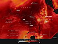 Southsudan geos5 20240318 heat wave.jpg 720 × 545; 278 KB
-
 Sub Saharan Africa Climate Map.png 2,560 × 1,516; 753 KB
-

-
-

-
-
 Vegetation africa ar.png 1,295 × 1,165; 735 KB
-
 West African floods of 2010.png 1,357 × 631; 52 KB
-
 Wind Power Density in Africa from Global Wind Atlas.jpg 701 × 648; 100 KB
.jpg)
.jpg)
.jpg)
_(14773262961).jpg)


.jpg)


_(14758455926).jpg)

.png)


.jpg)


.png)


-Predicting-Future-Trends-pone.0047981.g001.jpg)
-Predicting-Future-Trends-pone.0047981.g002.jpg)
-Predicting-Future-Trends-pone.0047981.g005.jpg)
-Predicting-Future-Trends-pone.0047981.g007.jpg)


