Category:Maps of the territorial evolution of Ukraine
Jump to navigation
Jump to search
Countries of Europe: Ukraine
Media in category "Maps of the territorial evolution of Ukraine"
The following 9 files are in this category, out of 9 total.
-
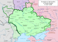 1917-1928 Soviet Ukraine borders formation (EN).svg 983 × 711; 10.91 MB
-
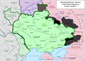 1917-1928 Soviet Ukraine borders formation.svg 983 × 711; 11.03 MB
-
 Ukraine&Russia.gif 320 × 240; 2.9 MB
-
 Ukraine-growth-fr.png 1,600 × 950; 220 KB
-
 Ukraine-growth.png 800 × 475; 252 KB
-
 ZakapratskaUkraina1945.png 2,556 × 2,024; 4.19 MB
-
 Про Закарпатську Україну. Зобр. №3.png 1,431 × 1,144; 1.09 MB
-
 Территориальные изменения Украины.gif 1,400 × 1,035; 1.09 MB
-
 Территориальные приращения Украины.jpg 1,181 × 1,020; 307 KB
.svg)


