Category:Maps of the quarters of Basel
Jump to navigation
Jump to search
Media in category "Maps of the quarters of Basel"
The following 24 files are in this category, out of 24 total.
-
 Badergasse 12 Basel.jpg 5,246 × 2,939; 2.78 MB
-

-
 Karte Altstadt Grossbasel.png 885 × 1,141; 221 KB
-
 Karte Altstadt Kleinbasel.png 885 × 1,141; 221 KB
-
 Karte Am Ring.png 885 × 1,141; 220 KB
-
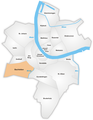 Karte Bachletten.png 885 × 1,141; 219 KB
-
 Karte Basel Quartiere.png 1,476 × 1,766; 360 KB
-
 Karte Basel Quartiere2.png 885 × 1,141; 324 KB
-
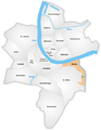 Karte Breite.png 885 × 1,141; 322 KB
-
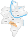
 Karte Bruderholz.png 885 × 1,141; 314 KB
-
 Karte Clara.png 885 × 1,141; 324 KB
-
 Karte Gotthelf.png 885 × 1,141; 321 KB
-
 Karte Gundeldingen.png 885 × 1,141; 320 KB
-
 Karte Hirzbrunnen.png 885 × 1,141; 314 KB
-
 Karte Iselin.png 885 × 1,141; 320 KB
-
 Karte Kleinhüningen.png 885 × 1,141; 319 KB
-
 Karte Klybeck.png 885 × 1,141; 319 KB
-
 Karte Matthäus.png 885 × 1,141; 321 KB
-
 Karte Rosental.png 885 × 1,141; 322 KB
-
 Karte St. Alban.png 885 × 1,141; 315 KB
-
 Karte St. Johann.png 885 × 1,141; 316 KB
-
 Karte Vorstädte.png 885 × 1,141; 322 KB
-
 Karte Wettstein.png 885 × 1,141; 321 KB
-
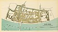
 UBBasel Map 1796 VB A2-2-6 Klein-Hueningen.tiff 5,164 × 5,173, 2 pages; 76.45 MB

%27_(11215177505).jpg)


