Category:Maps of the province of Padua
Jump to navigation
Jump to search
Subcategories
This category has the following 4 subcategories, out of 4 total.
Media in category "Maps of the province of Padua"
The following 8 files are in this category, out of 8 total.
-
 Carta tecnica regionale dell'Eremo sul Monte Rua.png 481 × 338; 190 KB
-
 Mappa catastale Castello Lispida Monselice.png 663 × 528; 592 KB
-
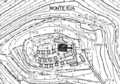
 Mappa di Monte Castello (Montegrotto Terme).jpg 1,010 × 863; 135 KB
-
 Mappa intersezione A4 - A13.png 771 × 673; 392 KB
-
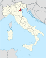 Padova in Italy.svg 1,034 × 1,299; 3 MB
-
 Padova mappa.png 725 × 731; 260 KB
-
 Padova posizione.png 350 × 424; 11 KB
-
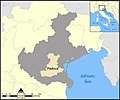 Veneto Provincia Padova.jpg 1,000 × 836; 256 KB


.jpg)


