Category:Maps of the power grid in Germany
Jump to navigation
Jump to search
Countries of Europe: Germany · United Kingdom
Media in category "Maps of the power grid in Germany"
The following 13 files are in this category, out of 13 total.
-
 Bahnstromnetz.png 2,070 × 2,711; 5.04 MB
-
 German high-voltage grid 1940s.png 1,742 × 1,564; 344 KB
-
 German high-voltage overhead power line grid.svg 603 × 775; 17.56 MB
-
 German medium-voltage overhead power line grid.svg 620 × 775; 32.97 MB
-
 Karte BBPlG-Vorhaben.png 1,680 × 2,115; 915 KB
-
 Karte EnLAG-Vorhaben.png 1,680 × 2,115; 714 KB
-
 Karte Höchstspannungsnetz Deutschland.png 1,625 × 2,022; 1.03 MB
-
 Map of the offshore wind power farms in the German Bight.png 4,342 × 3,483; 2.6 MB
-
 NRV erweiterung Abb5.jpg 1,077 × 1,022; 117 KB
-
 NRV regelenergiemarkt Abb4.jpg 1,129 × 987; 111 KB
-
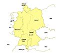
 Regelzonen deutscher Übertragungsnetzbetreiber neu.png 700 × 915; 185 KB
-
 Regelzonen mit Übertragungsnetzbetreiber in Deutschland.png 592 × 801; 118 KB
-
 Regelzonen Übertragungsnetzbetreiber in Deutschland.svg 592 × 801; 158 KB


