Category:Maps of the history of the Channel Islands
Jump to navigation
Jump to search
Use the appropriate category for maps showing all or a large part of the Channel Islands. See subcategories for smaller areas:
| If the map shows | Category to use |
|---|---|
| the Channel Islands on a recently created map | Category:Maps of the Channel Islands or its subcategories |
| the Channel Islands on a map created more than 70 years ago | Category:Old maps of the Channel Islands or its subcategories |
| the history of the Channel Islands on a recently created map | Category:Maps of the history of the Channel Islands or its subcategories |
| the history of the Channel Islands on a map created more than 70 years ago | Category:Old maps of the history of the Channel Islands or its subcategories |

Subcategories
This category has only the following subcategory.
*
Media in category "Maps of the history of the Channel Islands"
The following 7 files are in this category, out of 7 total.
-
 Map Kingdom of Brittany 845-867-de.svg 736 × 624; 250 KB
-
 Map Kingdom of Brittany 845-867-es.svg 700 × 600; 179 KB
-
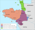
 Map Kingdom of Brittany 845-867-fr.svg 700 × 600; 39 KB
-
 Map Kingdom of Brittany 845-867-hu.svg 700 × 600; 41 KB
-
 Map Kingdom of Brittany 845-867-pt.svg 700 × 600; 41 KB
-
 Map Kingdom of Brittany 845-867-ru.svg 700 × 600; 57 KB
-
 Normaundie carte.jpg 2,048 × 1,470; 243 KB


