Category:Maps of the history of Novi Sad
Jump to navigation
Jump to search
Media in category "Maps of the history of Novi Sad"
The following 22 files are in this category, out of 22 total.
-
 Novi sad bivse opstine01.png 1,112 × 890; 52 KB
-
 Novi sad bivse opstine02.png 1,001 × 1,240; 86 KB
-
 Novi sad map 1745.jpg 3,112 × 2,054; 2.33 MB
-
 Novi sad map 1805.jpg 1,608 × 2,682; 2.13 MB
-
 Novi sad map 1845.jpg 2,106 × 2,670; 3.08 MB
-
 Novi sad quarters ethnic.png 1,800 × 2,646; 970 KB
-
 Novi sad razvoj naselja.png 1,800 × 2,512; 475 KB
-
 Novi sad stara naselja01a.png 1,800 × 2,112; 443 KB
-
 Novi sad stara naselja01b.png 1,800 × 2,112; 441 KB
-
 Novi sad stara naselja01c.png 1,800 × 2,112; 423 KB
-
 Novi sad stara naselja02.png 1,800 × 2,112; 423 KB
-
 Novi sad stara naselja03.png 1,800 × 2,116; 405 KB
-
 Novi sad stara naselja04.png 1,800 × 2,112; 353 KB
-
 NoviSadtrammap.png 1,146 × 767; 716 KB
-
 Petrovaradin 1688.jpg 239 × 302; 14 KB
-
 Petrovaradin 1692.jpg 382 × 295; 19 KB
-
 Petrovaradin 1693.jpg 300 × 212; 13 KB
-
 Péterváradi csata-1716.jpg 800 × 617; 250 KB
-
 Ratzen stadt 18thcentury.jpg 1,521 × 1,146; 896 KB
-
 Ratzen Stadt01.jpg 582 × 804; 780 KB
-
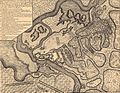
 Ratzenstatt and almas 1716 17.jpg 1,486 × 938; 680 KB
-
 Siege of Petrovaradin 1694.jpg 300 × 226; 20 KB


