Category:Maps of the history of Nigeria
Jump to navigation
Jump to search
Countries of Africa: Algeria · Angola · Benin · Botswana · Burkina Faso · Burundi · Cameroon · Central African Republic · Chad · Democratic Republic of the Congo · Republic of the Congo · Djibouti · Egypt‡ · Equatorial Guinea · Eritrea · Eswatini · Ethiopia · Gabon · The Gambia · Ghana · Guinea · Guinea-Bissau · Ivory Coast · Kenya · Lesotho · Liberia · Libya · Madagascar · Malawi · Mali · Mauritania · Morocco · Mozambique · Namibia · Niger · Nigeria · Rwanda · Senegal · Sierra Leone · Somalia · South Africa · South Sudan · Sudan · Tanzania · Togo · Tunisia · Uganda · Zambia · Zimbabwe
Limited recognition: Ambazonia · Azawad · Somaliland – Other areas: Ceuta · Melilla · Réunion · Western Sahara
‡: partly located in Africa
Limited recognition: Ambazonia · Azawad · Somaliland – Other areas: Ceuta · Melilla · Réunion · Western Sahara
‡: partly located in Africa
Subcategories
This category has the following 6 subcategories, out of 6 total.
B
M
- Maps of Biafra (24 F)
- Maps of Kanem Empire (7 F)
- Maps of Kanem-Bornu (24 F)
- Maps of the Oyo Empire (6 F)
- Maps of the Sokoto Caliphate (14 F)
Media in category "Maps of the history of Nigeria"
The following 70 files are in this category, out of 70 total.
-
 1729 West Africa map (Cameroon & Nigeria).jpg 466 × 355; 266 KB
-
 1898 Niger map byJohnston BPL m0612007.png 545 × 749; 714 KB
-
 Niger Nigeria border map 1906.png 1,024 × 384; 37 KB
-
 Boko Haram insurgency map.svg 954 × 734; 399 KB
-
 ECDM 20160714 ECHO LakeChad BokoHaramCrisis (002).pdf 1,754 × 1,239; 485 KB
-
 ECDM 20161108 LakeChad BokoHaramCrisis.pdf 1,754 × 1,239; 464 KB
-
 Islamist insurgency in Nigeria-es.svg 600 × 600; 921 KB
-
 Islamist insurgency in Nigeria.svg 254 × 254; 412 KB
-
 3-oyo-empire-at-its-greatest-extent-c-1780.jpg 3,331 × 4,394; 5.33 MB
-
 Administration-regions-Nigeria-1851-today.jpg 1,500 × 2,160; 451 KB
-
 Africa de l'Oèst (fin sègle XVIII).png 1,192 × 592; 172 KB
-
 Africa de l'Oèst en 1875-es.svg 1,588 × 771; 750 KB
-
 Africa de l'Oèst en 1875-hu.svg 1,588 × 771; 263 KB
-
 Africa de l'Oèst en 1875.png 1,192 × 596; 195 KB
-
 Bayajidda-deu3.jpg 1,192 × 945; 173 KB
-
 Bayajidda-deu4.jpg 1,192 × 945; 175 KB
-
 Bayajidda-deu5.jpg 1,668 × 1,323; 274 KB
-
 Bayajidda-eng.jpg 1,192 × 945; 158 KB
-
 Bayajidda-eng2.jpg 1,192 × 945; 160 KB
-
 Bayajidda-eng3.jpg 1,192 × 945; 172 KB
-
 Bayajidda-eng4.jpg 1,192 × 945; 174 KB
-
 Bayajidda-eng5.jpg 1,668 × 1,323; 272 KB
-
 Boko Haram conflict map.png 270 × 221; 22 KB
-
 Borgu.jpeg 614 × 376; 167 KB
-
 BorguScale.jpeg 575 × 370; 152 KB
-
 British-expansion-in-Nigeria-1891-1909.jpg 1,668 × 1,323; 310 KB
-
 British-expansion-in-Nigeria-1895-1906.jpg 1,668 × 1,323; 260 KB
-
 Edo.jpeg 399 × 261; 91 KB
-
 EdoScale.jpeg 399 × 261; 90 KB
-
 Empèri Songai.png 1,104 × 727; 124 KB
-
 Expeditions rome nigeria rivers westafrica.jpg 1,587 × 1,323; 353 KB
-
 Expeditions rome nigeria.jpg 1,133 × 945; 184 KB
-
 Expeditions rome nigeria2.jpg 1,587 × 1,323; 325 KB
-
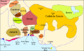
 Fula jihad states map general c1830-es.svg 1,332 × 796; 251 KB
-
 Fula jihad states map general c1830-pt.svg 1,332 × 796; 252 KB
-
 Fula jihad states map general c1830.png 694 × 408; 94 KB
-
 Gongola State Nigeria.jpg 1,869 × 1,658; 197 KB
-
 Idoma.jpeg 556 × 376; 155 KB
-
 Igala.jpeg 579 × 374; 165 KB
-
 IjawHistory.jpeg 418 × 371; 117 KB
-
 Kanem-Bornu 1650.svg 686 × 970; 1.43 MB
-
 Kwararafa-pt.svg 425 × 334; 21 KB
-
 Kwararafa.jpeg 425 × 334; 131 KB
-
 Map of Kano-1826.jpg 760 × 492; 65 KB
-
 Map of Katsina (1798) by James Rennell.jpg 3,895 × 2,594; 1.13 MB
-
 Migration pattern of the Olukumi.jpg 901 × 739; 207 KB
-
 Nigeria 1960-1963.png 1,869 × 1,658; 90 KB
-
 Nigeria 1963-1967.png 1,869 × 1,658; 101 KB
-
 Nigeria 1991-1996.png 1,869 × 1,658; 125 KB
-
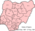 Nigeria states 1987-1991.png 1,869 × 1,658; 106 KB
-
 Nigeria states-1967-1976.png 1,869 × 1,658; 137 KB
-
 Nigeria states-1976-1987.png 1,869 × 1,658; 93 KB
-
 Nigeria1914gbr.jpg 1,153 × 957; 390 KB
-
 Nigèria - Guèrra de Biafra.png 1,099 × 533; 340 KB
-
 Nigèria - Situacion politica vèrs 1875.png 867 × 527; 144 KB
-
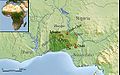
 Nok mapaEU.png 331 × 352; 55 KB
-
 Nok-map.png 331 × 352; 46 KB
-
 Nupe.jpeg 649 × 537; 250 KB
-
 Oyoxviii.jpeg 545 × 341; 156 KB
-
 Rabih Azzubair Dominions.png 1,806 × 1,155; 1.09 MB
-
 The Greatest Extend of Wilāyat al Sūdān al Gharbī.svg 254 × 254; 851 KB
-
 The States of the Nigerian Region in the 16th century.png 2,066 × 1,638; 521 KB
-
 UBBasel Map 1677 Kartenslg Mappe 252-40 Guinée.tiff 10,995 × 7,692, 2 pages; 241.99 MB
-
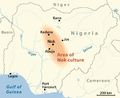 Verbreitung Nok-Kultur-en.png 1,068 × 871; 387 KB
-
 Verbreitung Nok-Kultur-ru.png 1,069 × 869; 445 KB
-
 Verbreitung Nok-Kultur.png 1,069 × 870; 499 KB
-
 WestAfrica1625-es.svg 606 × 397; 637 KB
-
 WestAfrica1625-pt.svg 606 × 397; 637 KB
-
 WestAfrica1625.png 498 × 306; 31 KB
-
 África occidental en 1625.svg 606 × 397; 637 KB
.jpg)


.png)


_by_James_Rennell.jpg)


