Category:Maps of the history of Montenegro in the Middle Ages (with current borders)
Jump to navigation
Jump to search
Media in category "Maps of the history of Montenegro in the Middle Ages (with current borders)"
The following 13 files are in this category, out of 13 total.
-
 1373 Pljevlja Zupa Breznica.jpg 1,024 × 1,186; 136 KB
-
 1373 Propast Nikole Altomanovica Vojinovica.jpg 1,024 × 1,154; 167 KB
-
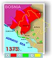 Bosnia and Zeta 1373.jpg 1,024 × 1,154; 164 KB
-
 Expansion the Kingdom of Bosnia in the XIV c.svg 2,075 × 2,299; 25 KB
-
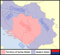
 Serbia in the end of XIII th c and Montenegro today.svg 564 × 420; 33 KB
-
 Serbia960AD.png 900 × 820; 146 KB
-
 Sirenje Bosne u XIV vijeku.svg 2,077 × 2,365; 24 KB
-
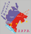
 Sirenje Bosne XIV v.jpg 1,053 × 1,200; 136 KB
-
 Srbija na kraju XIII vijeka i sadasnje granice Crne Gore.svg 564 × 420; 36 KB
-
 Zeta 1373 Medieval.jpg 1,024 × 1,154; 152 KB
-
 Zeta 1377.jpg 1,024 × 1,142; 140 KB
-
 Zeta Djuradja I Balsica 1377 godine.jpg 1,024 × 1,142; 148 KB
-
 Жупаније у средњовјековној Црној Гори.jpg 3,491 × 4,256; 1.16 MB


