Category:Maps of the history of Maharashtra
Jump to navigation
Jump to search
States of India: Andhra Pradesh · Assam · Goa · Himachal Pradesh · Karnataka · Kerala · Maharashtra · Tamil Nadu · Telangana · West Bengal
Union territories: Dadra and Nagar Haveli and Daman and Diu · Delhi · Jammu and Kashmir · Ladakh · Puducherry
Former states of India:
Former union territories:
Union territories: Dadra and Nagar Haveli and Daman and Diu · Delhi · Jammu and Kashmir · Ladakh · Puducherry
Former states of India:
Former union territories:
Subcategories
This category has the following 7 subcategories, out of 7 total.
B
- Maps of Bombay Presidency (11 F)
C
- Maps of the Chalukya Empire (18 F)
H
M
S
- Maps of the Satavahana Empire (28 F)
Media in category "Maps of the history of Maharashtra"
The following 11 files are in this category, out of 11 total.
-
 BahmaniEmpire.png 1,554 × 972; 56 KB
-
 Chalukya territories lg.png 612 × 421; 105 KB
-
 Extent of the Satavahanas.png 1,027 × 909; 196 KB
-
 Karta sodra indien 1500-es.svg 917 × 957; 1.97 MB
-
 Karta sodra indien 1500.jpg 300 × 381; 17 KB
-
 Kharavela-Kingdom.GIF 400 × 337; 11 KB
-
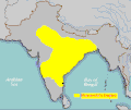
 Map of the Abhira Empire.png 543 × 600; 161 KB
-
 Map of the Northern Province of Portuguese India.png 777 × 1,903; 395 KB
-
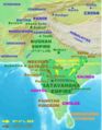 SatavahanaMap.jpg 1,123 × 1,440; 327 KB
-
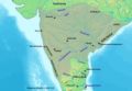
 South India in 300 CE.jpg 804 × 563; 62 KB
-
 WKshatrapas.jpg 1,121 × 1,440; 309 KB


