Category:Maps of the history of Hungary in the Late Middle Ages
Jump to navigation
Jump to search
Subcategories
This category has only the following subcategory.
Media in category "Maps of the history of Hungary in the Late Middle Ages"
The following 50 files are in this category, out of 50 total.
-
 1264-65 Hungarian civil war.jpg 851 × 567; 199 KB
-
 15szeleje.jpg 800 × 595; 46 KB
-
 A Magyar Királyság a 14. század közepén.JPG 800 × 595; 51 KB
-
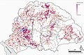 A Magyar Királyság plébániasűrűsége 1330 körül.jpg 718 × 470; 290 KB
-
 A Moldvai Fejedelemség és a Magyar Királyság.png 6,255 × 3,526; 2.36 MB
-
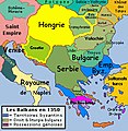 AtlBalk1350.jpg 318 × 327; 177 KB
-
 AtlBalk1400.jpg 318 × 327; 163 KB
-
 AtlBalk1500.jpg 318 × 327; 162 KB
-
 Az 1332-1337. évi pápai tizedjegyzék - Fizetett pápai tized településenként.jpg 1,501 × 1,969; 1.99 MB
-
 Bélteki Balk’s territories in the Kingdom of Hungary (cca. 1388).png 4,736 × 3,526; 544 KB
-
 Campus Lucsco et Provincia Lucensis.png 1,600 × 1,229; 1.59 MB
-
 Coloman's state.png 3,100 × 2,800; 726 KB
-
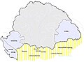
 East-hungary16th.PNG 310 × 260; 37 KB
-
 Habsburg mortgages in Hungary between 15th and 17th centuries.jpg 1,417 × 1,006; 801 KB
-
 Hungarian post-Matthias succession wars (1490-94).jpg 1,700 × 1,474; 487 KB
-
 Hungarian-Ottoman border at the beginning of the 16th century-es.svg 1,485 × 582; 314 KB
-
 Hungarian-Ottoman border at the beginning of the 16th century.png 1,485 × 582; 332 KB
-
 Hungarian-Ottoman border at the beginning of the 16th century.svg 1,485 × 582; 369 KB
-
 Hungary 1260s.jpg 831 × 549; 209 KB
-
 Hungary 1370-1387.jpg 609 × 491; 133 KB
-
 Hungary 1480.jpg 609 × 491; 132 KB
-
 Hungary 1490 (PL2018).png 1,381 × 1,074; 2.72 MB
-
 Jagiellon Realm.png 587 × 511; 13 KB
-
 Kis-vlachföldek.png 835 × 626; 567 KB
-
 Kiskirályok uralmi területei.jpg 603 × 474; 102 KB
-
 Koh administrative 1370 01.png 1,228 × 939; 128 KB
-
 Koh administrative 1370 02.png 1,228 × 939; 122 KB
-
 Kotor and Balsa II Balsic XIV cAD.svg 800 × 600; 283 KB
-
 Louis the Great.jpg 1,135 × 790; 292 KB
-
 Louis the Great2.jpg 1,200 × 936; 443 KB
-
 Louis's kingdoms and his vassal territories.png 1,817 × 1,120; 3.3 MB
-
 Macvanska banovina-sr.png 667 × 790; 50 KB
-
 Macvanska banovina-vi.png 667 × 699; 39 KB
-
 Macvanska banovina.png 667 × 790; 73 KB
-
 Magyarország a középkorban.png 4,736 × 3,526; 1.79 MB
-
 Map of Hungary in 1490.png 1,500 × 1,480; 242 KB
-
 Matthiascorvinusmap01.jpg 1,135 × 862; 364 KB
-
 Mátyás király birodalma.png 3,216 × 2,449; 2.23 MB
-
 Mátyás király országai.png 3,065 × 3,127; 1.54 MB
-
 Oligarch domains 1301 1310 hu.png 922 × 557; 137 KB
-
 Oligarch domains 1301 1310.png 922 × 557; 81 KB
-
 Oligarchs in the Kingdom of Hungary 14th century SK.svg 991 × 778; 203 KB
-
 Oligarchs in the Kingdom of Hungary 14th century-es.svg 1,057 × 830; 870 KB
-
 Oligarchs in the Kingdom of Hungary 14th century-hu.svg 991 × 778; 338 KB
-
 Oligarchs in the Kingdom of Hungary 14th century.svg 991 × 778; 334 KB
-
 Oligarchs in the Kingdom of Hungary.png 603 × 474; 406 KB
-
 PNG Jagelon.png 1,268 × 1,054; 90 KB
-
 SAP Nitra region 1493.jpg 600 × 580; 81 KB
-
 The wars of Matthias Corvinus of Hungary (1458-1490).png 1,700 × 1,707; 637 KB
-
 Zapolya.jpg 1,814 × 1,110; 1.22 MB


.png)


.jpg)


.png)


.png)
