Category:Maps of the history of Honduras
Jump to navigation
Jump to search
Subcategories
This category has the following 6 subcategories, out of 6 total.
M
- Maps of Mosquitia (63 F)
O
Media in category "Maps of the history of Honduras"
The following 11 files are in this category, out of 11 total.
-
 Kolonie Belg-Honduras (Santo Tomás de Castilla).jpg 528 × 647; 262 KB
-
 Antiguo Mapa de Honduras.JPG 910 × 716; 168 KB
-
 Area Cerámica Copador.svg 1,465 × 1,197; 383 KB
-

-
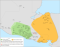
 Battles for control of Honduras 1524.png 1,063 × 792; 1.39 MB
-
 Esferas ceramicas Providencia-Miraflores y Uapala.png 4,291 × 3,374; 878 KB
-
 Yucatan Conquest.jpg 2,594 × 2,710; 1.1 MB
-
 Maya region w english names.png 1,076 × 828; 312 KB
-
 Maya region w german names.png 1,076 × 828; 320 KB
-
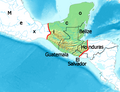
 Settlements of and groups 16th century Honduras-Higueras.gif 612 × 570; 159 KB
-
 Territories of the Governorate of Veragua.jpg 720 × 960; 137 KB
.jpg)


