Category:Maps of the history of Herzegovina
Jump to navigation
Jump to search
Subcategories
This category has the following 4 subcategories, out of 4 total.
M
- Maps of Hum (12 F)
- Maps of the Old Herzegovina (7 F)
- Maps of Travunija (44 F)
- Maps of Zachlumia (46 F)
Media in category "Maps of the history of Herzegovina"
The following 54 files are in this category, out of 54 total.
-
 Bosanski pašaluk 1600. godine.png 2,250 × 1,536; 1.27 MB
-
 Bosnia and Herzegovina in 1911 map-es.svg 2,005 × 2,165; 309 KB
-
 Bosnia and Herzegovina in 1911 map-fr.svg 2,005 × 2,165; 142 KB
-
 Bosnia Eyalet, Central europe 1683-ar.png 1,499 × 974; 878 KB
-
 Bosnia Eyalet, Central europe 1683-es.svg 2,555 × 1,672; 835 KB
-
 Bosnia Eyalet, Central europe 1683.png 1,499 × 974; 795 KB
-
 Bosnia1878.svg 662 × 684; 475 KB
-
 Bosnie et Sandjak 1904 ES.svg 2,005 × 2,066; 344 KB
-
 Bosnie et Sandjak 1904 hu.png 800 × 824; 166 KB
-
 Bosnie et Sandjak 1904 mk.svg 2,000 × 1,826; 132 KB
-
 Bosnie et Sandjak 1904.svg 2,000 × 1,826; 139 KB
-
 Bosznia és Szandzsák 1904.svg 2,000 × 1,826; 139 KB
-
 Bunjevci migrations hu.svg 937 × 900; 88 KB
-
 Bunjevci migrations-sr.png 937 × 900; 107 KB
-
 Bunjevci migrations.png 937 × 900; 128 KB
-
 Croat realms in the first half of 14th century.png 2,230 × 1,944; 208 KB
-
 Paganija, Zahumlje, Travunija, Duklja, Croatian view-es.svg 805 × 590; 1.08 MB
-
 Paganija, Zahumlje, Travunija, Duklja, Croatian view.png 698 × 486; 37 KB
-
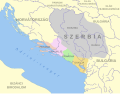
 Hercegovački sandžak.png 2,250 × 1,341; 827 KB
-
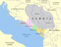
 Herzegovina in 1862.png 1,119 × 1,240; 1.04 MB
-
 Map of the Kingdom of Croatia (1848).png 542 × 502; 39 KB
-
 Map of the Kingdom of Croatia (1868).png 542 × 502; 40 KB
-
 Map of the Serb Uprising of 1596–97.jpg 600 × 700; 168 KB
-
 Operacija Lipanjske zore.png 1,016 × 955; 79 KB
-
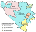
 SAO BIH 1991 1992-sr.png 972 × 866; 69 KB
-
 SAO BIH 1991 1992.png 972 × 866; 69 KB
-
 SAO BIH 1991 nov 01.png 972 × 866; 72 KB
-
 SAO BIH 1991 nov 02.png 972 × 866; 73 KB
-
 Sclavinie BiH.png 1,809 × 1,752; 113 KB
-
 Serb lands in the 9th century (hu).svg 935 × 728; 64 KB
-
 Српске склавиније 7. век.png 3,408 × 2,646; 10.41 MB
-
 Serb lands in the 9th century (en).png 701 × 546; 37 KB
-
 Serb lands in the 9th century.png 926 × 751; 75 KB
-
 Serb lands02.jpg 926 × 751; 78 KB
-
 Serb lands pl.png 926 × 751; 77 KB
-
 20070716111140!Serb lands old ver.png 701 × 546; 343 KB
-
 Territoires serbes IXe.jpg 701 × 546; 184 KB
-
 Serb lands in the 9th century-es.svg 1,861 × 1,642; 289 KB
-
 Serb lands in the 10th century (en).png 926 × 751; 70 KB
-
 Serb lands in the 10th century es.svg 746 × 654; 234 KB
-
 Serb lands in the 10th century (sr).png 926 × 751; 70 KB
-
 Serb tribes pl.png 442 × 377; 98 KB
-
 Srbsko IX es.svg 1,259 × 1,024; 218 KB
-
 Srbsko IX HE.svg 1,113 × 974; 215 KB
-
 Srbsko IX pt.svg 1,245 × 1,021; 189 KB
-
 Srbsko IX ru.svg 1,259 × 1,024; 265 KB
-
 Srbsko IX sr.svg 1,259 × 1,024; 263 KB
-
 Srbsko IX v2 es.svg 1,259 × 1,024; 237 KB
-
 Srbsko IX v2 pt.svg 1,245 × 1,021; 172 KB
-
 Srbsko XI pt.svg 420 × 350; 240 KB
-
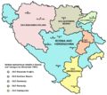
 Srpske autonomne oblasti u Bosni i Hercegovini u studenome 1991.png 1,809 × 1,752; 65 KB
-
 Srpske autonomne oblasti u Bosni i Hercegovini.png 1,809 × 1,752; 84 KB
-
 Tomislav BiH(925).png 1,809 × 1,752; 127 KB
-
 Trpimir BiH(845).png 1,809 × 1,752; 108 KB


.png)
.png)


.svg)

.png)


.png)

.png)


.png)
.png)