Category:Maps of the history of Central Asia
Jump to navigation
Jump to search
- Maps of the history of Central Asia.
Subcategories
This category has the following 10 subcategories, out of 10 total.
B
G
M
- Maps of Syr-Darya Oblast (4 F)
- Maps of the Silk Road (56 F)
P
- Ptolemy's 7th Asian Map (41 F)
- Ptolemy's 8th Asian Map (39 F)
Media in category "Maps of the history of Central Asia"
The following 97 files are in this category, out of 97 total.
-
 1090 Yılında Oğuzlar.png 1,080 × 1,080; 931 KB
-
 Moghulistan.PNG 1,075 × 500; 995 KB
-
 Kazakh Khanate map.jpg 1,080 × 857; 111 KB
-
 175bc.jpg 579 × 258; 139 KB
-
 Central Asia 1870.png 1,009 × 796; 485 KB
-
 1878 Oğuz Türkü Dağılımı Haritası.png 1,080 × 1,080; 946 KB
-
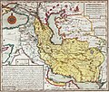
 Heinrich Kiepert. Imperia Persarum et Macedonum. 1903 (K).jpg 3,045 × 3,667; 7.54 MB
-
 Heinrich Kiepert. Imperia Persarum et Macedonum. 1903 (KA).jpg 2,963 × 2,471; 5.3 MB
-
 Persian rule & overlordship c.1800 in Central Asia.jpg 2,291 × 2,490; 2.14 MB
-
 2. Beylikler Dönemi Oğuzlar.png 1,080 × 1,080; 921 KB
-
 9. Yüzyılda Oğuzların Harita Üzerinde Dağılımı.png 1,080 × 1,080; 929 KB
-
 A Tarim-medence királyságai.png 2,106 × 1,061; 3.79 MB
-
 AlashAutonomyKK.png 1,400 × 1,108; 95 KB
-
 AlashOrdaRU.png 1,400 × 1,108; 98 KB
-
 Asya Hun, Hiung-nu - Xiongnu.png 1,080 × 1,080; 1.39 MB
-
 Avrupa Hun Haritası - Hunnic Empire.png 1,080 × 1,080; 1.27 MB
-
 Basra bahrefars.jpg 1,340 × 1,140; 887 KB
-
 Batı Göktürk.png 1,080 × 1,080; 1.39 MB
-
 Battle of Qatwan.png 1,276 × 905; 2.17 MB
-
 Battle of Talas.png 1,081 × 738; 1.53 MB
-
 BMAC.png 450 × 335; 150 KB
-
 CentalAsia 200bc.jpg 1,052 × 622; 208 KB
-
 Central Asia 1900 mk.svg 658 × 536; 125 KB
-
 Central Asia 1900-en.svg 658 × 536; 154 KB
-
 Central Asia 1900-es.svg 658 × 536; 120 KB
-
 Central Asia 1900-ko.svg 658 × 536; 159 KB
-
 Central Asia 1900-ru.svg 658 × 536; 140 KB
-
 CentralAsia 001ad.jpg 1,013 × 530; 180 KB
-
 CentralAsia 100bc.jpg 989 × 568; 178 KB
-
 CentralAsia 200ad.jpg 984 × 604; 213 KB
-
 CentralAsia 400ad.jpg 984 × 538; 176 KB
-
 Chupanid - Jalayerid dyansty 1337–1432 ad-ar.png 620 × 428; 37 KB
-
 Chupanid - Jalayerid dyansty 1337–1432 ad.PNG 620 × 428; 23 KB
-
 Conquest of Western Turks.png 1,062 × 736; 1.6 MB
-
 DesmembramientoDelIljanato1337–1432(v2)-pt.svg 982 × 685; 267 KB
-
 DesmembramientoDelIljanato1337–1432.svg 1,801 × 1,373; 2.13 MB
-
 Dungan Revolt Map.png 1,125 × 795; 369 KB
-
 Eastern Chagatai 1372.jpg 1,103 × 750; 190 KB
-
 From Neolithic to Bronze Age in China.jpg 1,500 × 1,005; 1.3 MB
-
 Geography avesta grenet.png 2,330 × 1,382; 4.06 MB
-
 Hindu Shahis territory.png 964 × 805; 765 KB
-
 Ice Age glacial lakes of Siberia and Central Asia - de.svg 1,238 × 1,046; 3.79 MB
-
 Ice Age glacial lakes of Siberia and Central Asia - ru.svg 1,238 × 1,046; 4.19 MB
-
 Interior Asia 6th century.png 1,056 × 714; 936 KB
-
 Kangar Birliği.png 1,080 × 1,080; 1.37 MB
-
 Kartid-Kurtdynasty1244-1389.png 620 × 429; 19 KB
-
 KhorasanAR.jpg 1,920 × 1,080; 219 KB
-
 Kingdom of Khotan.png 1,275 × 904; 1.96 MB
-
 Kurt dynasty (greatest extent).svg 553 × 553; 270 KB
-
 Map of Sogdia.png 3,367 × 1,674; 3.84 MB
-
 Map of the Hindu Shahis (Hindu Kush).png 2,573 × 1,645; 9.06 MB
-
 Map of the Hindu Shahis.png 2,324 × 2,151; 7.19 MB
-
 Map of the history of Central Asia.png 279 × 281; 30 KB
-
 Map of the Indo-Greeks.png 2,324 × 2,151; 7.37 MB
-
 Map of the Kushano-Sasanian Kingdom.svg 4,257 × 2,148; 3.31 MB
-
 Map of the Kushano-Sasanians.png 3,196 × 1,840; 13.66 MB
-
 Map of the Rouran Khaganate.png 1,886 × 1,038; 4.49 MB
-
 Map of the Second Turkic Khaganate.png 3,196 × 1,840; 13.39 MB
-
 Map of the Shaybanids.png 3,196 × 1,840; 13.48 MB
-
 Map of the Tokhara Yabgus.png 3,196 × 1,840; 13.43 MB
-
 Map of the Western Turkic Khaganate.png 3,196 × 1,840; 13.46 MB
-
 Map of Tocharian areas.png 3,196 × 1,840; 13.45 MB
-
 Nirun, Tuyuhun, Yueban, Tuoba Wei.jpg 943 × 519; 230 KB
-
 Oğuzlar Günümüz.png 1,080 × 1,080; 902 KB
-
 Oğuzların 1600 Yılında Dağılımı Haritası.png 1,080 × 1,080; 935 KB
-
 QarakhanidMap1000.jpg 828 × 746; 94 KB
-
 Qing Dzungar wars.jpg 1,061 × 750; 163 KB
-
 Qocho Uyghurs.png 1,119 × 795; 1.1 MB
-
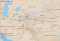
 Russian advance in Central Asia.jpg 1,071 × 861; 547 KB
-
 Samarkand-Bukhara Road Tenth Century.svg 550 × 250; 326 KB
-
 Seyanto Hanlığı - Xueyantuo.png 1,080 × 1,080; 1.32 MB
-
 Siyenpiler - Xianbei.png 1,080 × 1,080; 1.37 MB
-
 Soulier, E.; Andriveau-Goujon, J. Anciens Empires Jusqua Alexandre. 1838 (D).jpg 1,873 × 1,800; 834 KB
-
 Tamerla 1402-1403.png 2,500 × 1,675; 1.16 MB
-
 Tarimbecken 3. Jahrhundert.png 2,114 × 1,059; 4.03 MB
-
-
 Toharistan Yabguluğu.png 1,080 × 1,080; 1.28 MB
-
 Tokhara Yabghus 660 CE territory.png 298 × 292; 320 KB
-
 Tokhara Yabghus territory.png 1,544 × 1,165; 60 KB
-
 Transoxiana 8th century - ar.svg 1,387 × 672; 2.2 MB
-
 Transoxiana 8th century zh-hans.svg 1,300 × 630; 1.52 MB
-
 Transoxiana 8th century-es.svg 688 × 464; 39.53 MB
-
 Transoxiana 8th century.svg 1,300 × 630; 1.86 MB
-
 Transoxiana Parthian era.png 1,225 × 548; 772 KB
-
 Turk Shahi territory (fine).png 1,420 × 767; 23 KB
-
 Turk Shahi territory.png 579 × 318; 15 KB
-
 Turkestan Map1917.png 1,128 × 659; 69 KB
-
 Türk Dilleri.png 1,080 × 1,080; 1.24 MB
-
 Umayyad-Empire.png 680 × 451; 24 KB
-
 Various races of Central Asia in The 1st century BC.(ja).png 567 × 470; 532 KB
-
 Western Liao.png 1,276 × 905; 1.57 MB
-
 Xwaniratha.png 700 × 550; 63 KB
-
 İskitler - Schytians.png 1,080 × 1,080; 1.37 MB
-
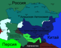
 Алашская автономия.jpg 800 × 628; 206 KB
-
 Картиды 1244-1389.png 620 × 429; 29 KB
-
 Найманская держава при Инанч хане.jpg 1,470 × 749; 317 KB
-
 Присоединение Туркестана и Кавказа.png 2,257 × 1,289; 3.88 MB


.jpg)
.jpg)


-pt.svg)


.svg)

.png)


.jpg)


.png)


.png)


