Category:Maps of the history of Albania in the Middle Ages
Jump to navigation
Jump to search
Countries of Europe: Albania · Bosnia and Herzegovina · Bulgaria · Croatia · Greece · Montenegro · North Macedonia · Romania · Serbia · Slovenia · Ukraine
Limited recognition: Kosovo
Limited recognition: Kosovo
Subcategories
This category has the following 4 subcategories, out of 4 total.
Media in category "Maps of the history of Albania in the Middle Ages"
The following 52 files are in this category, out of 52 total.
-
 Venice1400.png 647 × 563; 195 KB
-
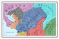
 Albania in the Middle Ages.png 600 × 600; 61 KB
-
 Albania invasions.jpg 461 × 643; 102 KB
-
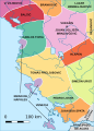
 Albanian Principalities, ca. 1390 (modern Albania).png 3,378 × 6,441; 7.96 MB
-
 Albanian rulers 1360.png 456 × 915; 69 KB
-
 Albanian rulers 1360v1.svg 839 × 1,169; 490 KB
-
 Albanian rulers 1360v2.svg 336 × 468; 324 KB
-
 Albanian States.svg 699 × 522; 54 KB
-
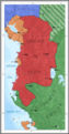
 Albanianprincipalities.png 435 × 325; 25 KB
-
 Albanians at 15 Centruy.jpg 353 × 589; 42 KB
-
 Albanians at 15 century 2.svg 353 × 577; 82 KB
-
 Albanians at 15 century blank.svg 353 × 577; 58 KB
-
 Albanians at 15 century.svg 353 × 577; 80 KB
-
 ALBKNIZECTVICZ.png 435 × 325; 26 KB
-
 Balsa II posjedi van Zete 1385 godine.png 263 × 480; 322 KB
-
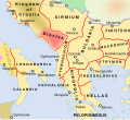
 Byzantine Greece ca 900 AD ZH.svg 797 × 632; 447 KB
-
 Byzantine Greece ca 900 AD-es.svg 787 × 640; 17.7 MB
-
 Byzantine Greece ca 900 AD-pt.svg 797 × 632; 446 KB
-
 Byzantine Greece ca 900 AD.svg 797 × 632; 1.18 MB
-
 Cupelnich distr. XI c AD.jpg 1,077 × 799; 158 KB
-
 Devolskikomitat.jpg 735 × 687; 68 KB
-
 Division of the area in Serbia by the nobility XIV cAD.svg 1,600 × 1,200; 203 KB
-
 Dukagjini (late 14th century).png 6,628 × 4,404; 6.92 MB
-
 Empire of the romans and serbs en.png 620 × 722; 62 KB
-
 Empire of the romans and serbs sr.png 620 × 722; 61 KB
-
 Empire of the romans and serbs-es.svg 334 × 386; 570 KB
-
 Gorsca-distr.---XI-c-AD.jpg 1,077 × 799; 150 KB
-
 Grad skadar i okolina u srednjem vijeku 2.svg 744 × 1,052; 84 KB
-
 JEZERSKE ZUPE XI-c-AD.JPG 1,140 × 606; 155 KB
-
 Kalojanborildevol.jpg 790 × 469; 31 KB
-
 Kastrioti, 1420.png 5,523 × 4,013; 5.87 MB
-
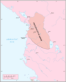
 Kingdom of Albania in 1368 AD.png 2,349 × 2,947; 584 KB
-
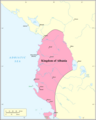 Kingdom of Albania.png 2,349 × 2,947; 593 KB
-
 League of Lezha (rus).JPG 600 × 900; 235 KB
-
 League of Lezha (ukr).jpg 600 × 900; 66 KB
-
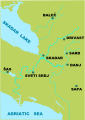
 League of Lezha.JPG 600 × 900; 41 KB
-
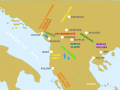
 League of Lezhë, 1448-1468.png 3,378 × 6,441; 9.29 MB
-
 Map Dyrrhachion.svg 455 × 414; 293 KB
-
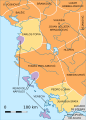
 Map of Arbanon (Arbëria).png 3,378 × 6,441; 6.27 MB
-
 Map of the Principality of Arbanon.png 2,349 × 2,947; 486 KB
-
 Medieval Balec and ancient roman roads.png 1,717 × 1,951; 372 KB
-

-
 Principality of Dukagjini.jpg 1,100 × 1,578; 1.35 MB
-
 Principality of Muzaka, 1372.png 3,066 × 1,147; 1.99 MB
-
 Principality of Muzakaj and State of Arianiti 15 century.JPG 481 × 398; 29 KB
-
 Proto-Albanian, 4th century.png 2,467 × 2,271; 3.02 MB
-
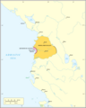
 Regnum albaniae 1272.png 637 × 836; 70 KB
-
 Srbija gospodari oblasti XIV v.svg 1,600 × 1,200; 205 KB
-
 Thopia, Arianiti and Gropa (late 14th century).png 3,314 × 2,408; 2.56 MB
-
 Venetian property, and invasion of the Serbian Despotate (Djuradj Brankovic).svg 1,222 × 1,243; 40 KB
-
 Venetian seaside properties in Montenegro 1448.png 1,020 × 1,024; 240 KB
-
 Venetian seside properties in Montenegro 1448-es.svg 1,156 × 1,170; 524 KB


.png)


.png)


.JPG)
.jpg)


.png)


.png)
.svg)

