Category:Maps of the ancient Kingdom of Illyria
Jump to navigation
Jump to search
Media in category "Maps of the ancient Kingdom of Illyria"
The following 23 files are in this category, out of 23 total.
-
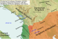 Illyria and Dardania Kingdoms (228 BC) (English).svg 1,037 × 686; 2.1 MB
-
 Illyria and Dardania Kingdoms (228 BC) (Portuguese).svg 1,037 × 686; 2.1 MB
-
 Illyria and Dardania Kingdoms (230 BC) (English).svg 1,037 × 686; 2.08 MB
-
 Illyria and Dardania Kingdoms (230 BC) (Portuguese).svg 1,037 × 686; 2.08 MB
-
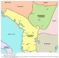 Illyria and Dardania Kingdoms-sr.png 1,596 × 1,576; 118 KB
-
 Illyria and Dardania Kingdoms.png 1,596 × 1,576; 118 KB
-
 Illyrian Kingdom of Agron in 231 BC (Hungarian).png 1,731 × 1,015; 2.44 MB
-
 Kingdom of Ballaios.png 2,190 × 1,773; 1.98 MB
-
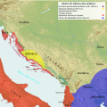
 KingdomofTeuta.png 2,000 × 2,000; 3.95 MB
-
 Map of the Kingdom of Agron of the Ardiaei (English).png 2,000 × 2,000; 3.95 MB
-
 Map of the Kingdom of Agron of the Ardiaei (English).svg 1,600 × 1,600; 6.46 MB
-
 Map of the Kingdom of Agron of the Ardiaei (Portuguese).svg 1,600 × 1,600; 6.46 MB
-
 Map of the Kingdom of Gentius in 169 BC (Hungarian).png 1,731 × 1,015; 2.39 MB
-
 Map of the Kingdom of Gentius of the Ardiaei (English).svg 1,600 × 1,600; 6.39 MB
-
 Map of the Kingdom of Gentius of the Ardiaei (Portuguese).svg 1,600 × 1,600; 6.39 MB
-
 Map of the Kingdom of Pinnes in 228 BC (Hungarian).png 1,731 × 1,015; 2.5 MB
-
 Map of the Kingdom of Teuta of the Ardiaei (English).svg 1,600 × 1,600; 6.46 MB
-
 Map of the Kingdom of Teuta of the Ardiaei (Portuguese).svg 1,600 × 1,600; 6.46 MB
-
 Map of the territory of Demetrius of Pharos (English).png 2,000 × 2,000; 3.95 MB
-
 Map of the territory of Demetrius of Pharos (English).svg 1,600 × 1,600; 6.43 MB
-
 PAEONIAN ARDIAEAN (ILLYRIAN) DARDANIAN KINGDOMS EXTENT DURING 230 BC.png 1,049 × 938; 1.88 MB
-
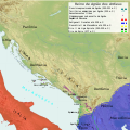
 Roman war in Illyricum 33 BC.png 2,724 × 2,204; 5.01 MB
-
 Taulantian Kingdom (King Glaucias).png 2,262 × 2,355; 2.6 MB
_(English).svg)
_(Portuguese).svg)
_(English).svg)
_(Portuguese).svg)


.png)


.png)
.svg)
.svg)
.png)
.svg)
.svg)
.png)
.svg)
.svg)
.png)
.svg)
_DARDANIAN_KINGDOMS_EXTENT_DURING_230_BC.png)

.png)