Category:Maps of the Ukrainian People's Republic
Jump to navigation
Jump to search
Subcategories
This category has only the following subcategory.
Media in category "Maps of the Ukrainian People's Republic"
The following 49 files are in this category, out of 49 total.
-
 Crimea 1.gif 420 × 300; 31 KB
-
 1918. Карта УНР.jpg 3,104 × 2,074; 3.16 MB
-
 Battle of Kruty.jpg 1,003 × 663; 82 KB
-

-
 Carte de ukraine 1919.jpg 934 × 593; 305 KB
-
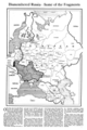
 Dismembered Russia — Some Fragments (NYT article, Feb. 17, 1918) cropped map.png 893 × 1,165; 326 KB
-
 Dismembered Russia — Some Fragments (NYT article, Feb. 17, 1918).png 3,000 × 4,500; 480 KB
-
 Flag map of Ukrainian People's Republic.svg 2,752 × 1,643; 34 KB
-
 Größte Ausbreitung der Truppen Grigor`evs.png 2,681 × 1,917; 215 KB
-
 Hotin issue, 1918.svg 1,423 × 1,238; 285 KB
-
 Krymska operatsia.jpg 720 × 1,040; 139 KB
-
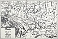
 L'Ukraine dans ses frontières suivant le principe ethnographique 1919.jpg 4,096 × 2,902; 3.01 MB
-
 Map of Ukraine (postcard 1919).jpg 2,000 × 1,284; 650 KB
-
 Map of Ukraine for Paris Peace Conference blank.svg 2,895 × 1,807; 176 KB
-
 Map of Ukraine for Paris Peace Conference no grid.svg 2,895 × 1,807; 277 KB
-
 Map of Ukraine for Paris Peace Conference-es.svg 2,970 × 1,880; 1.68 MB
-
 Map of Ukraine for Paris Peace Conference.jpg 3,000 × 1,984; 4.53 MB
-
 Map of Ukraine for Paris Peace Conference.svg 2,970 × 1,880; 280 KB
-
 Map of Ukraine, 1918.png 7,013 × 4,922; 74.04 MB
-
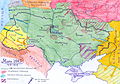
 Map of UNR 1918.png 3,104 × 2,074; 11.37 MB
-
 Ukraine 1918 de.jpg 1,597 × 1,181; 622 KB
-
 Ukraine 1920.jpg 3,500 × 2,333; 2.36 MB
-
 Ukraine Historical Borders.svg 988 × 605; 1.06 MB
-
 Ukraine in July 1919.png 1,166 × 777; 513 KB
-
 Ukrainian People Republic administrative division.png 932 × 595; 146 KB
-
 Ukrainian People's Republic in comparison with Ukraine in Europe.svg 1,401 × 1,198; 1.2 MB
-
 Ukrainian People's Republic in Europe.svg 1,401 × 1,198; 1.18 MB
-
 Ukrainian State 1918 divisions.png 1,690 × 1,038; 403 KB
-
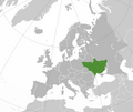
 Ukrainian State 1918. Europe.png 493 × 385; 53 KB
-
 UNR 17.08.1917.png 1,690 × 1,032; 454 KB
-
 UNR 1917.jpg 918 × 629; 95 KB
-
 UNR 1918 divisions-0.png 1,687 × 1,036; 290 KB
-
 UNR 1918 divisions-1.png 1,692 × 1,034; 584 KB
-
 UNR 1918 divisions.png 1,692 × 1,034; 400 KB
-
 UNR 1918.jpg 932 × 567; 228 KB
-
 UNR 2.1918 Brest-Litovsk.png 1,698 × 1,033; 432 KB
-
 UPR loc.png 2,023 × 1,900; 435 KB
-
 UPR Map 1918.png 387 × 388; 37 KB
-
 Дорожня карта України та суміжних держав, 1918 (1).jpg 2,200 × 1,590; 1.28 MB
-
 Дорожня карта України та суміжних держав, 1918 (2).jpg 2,200 × 1,605; 1.36 MB
-
 Мапа УНР.jpg 4,654 × 3,275; 6.16 MB
-
 Подністров'я земля УНР 1918.png 321 × 301; 27 KB
-
 Подністров'я земля УНР 2017.png 420 × 422; 24 KB
-
 Схема бою під Мотовилівкою.PNG 987 × 770; 541 KB
-
 Україна осінь 1919.svg 2,000 × 1,500; 413 KB
-
 Україна у своїх етноґрафічних межах.jpg 3,524 × 2,575; 2.84 MB
-
 Українсько-російська війна 1917-1921, бойові дії 10-17 липня 1919.jpg 957 × 711; 715 KB
-
 УНР.png 2,000 × 1,682; 375 KB
-
 오데사소비에트공화국.png 519 × 367; 87 KB


.jpg)

_cropped_map.png)
.png)


.jpg)


.jpg)
.jpg)


