Category:Maps of the Tatra Mountains
Jump to navigation
Jump to search
Subcategories
This category has the following 2 subcategories, out of 2 total.
O
- Old maps of the Tatra Mountains (18 F)
T
Pages in category "Maps of the Tatra Mountains"
This category contains only the following page.
Media in category "Maps of the Tatra Mountains"
The following 19 files are in this category, out of 19 total.
-
 Vnitřní Západní Karpaty, b11.svg 1,000 × 600; 106 KB
-
 Denkschriften - Österreichische Akademie der Wissenschaften (1900) (20670533449).jpg 2,860 × 1,286; 643 KB
-
 Map slovakia vysoke tatry.png 641 × 313; 52 KB
-
 Świstak tatrzański - rozmieszczenie w TPN.jpg 700 × 505; 43 KB
-
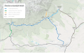
 Railways in High Tatras map en.svg 2,150 × 1,350; 3.27 MB
-
 Railways in High Tatras map sk.svg 2,150 × 1,350; 3.28 MB
-
 Railways in High Tatras schematic en.svg 1,100 × 550; 220 KB
-
 Railways in High Tatras schematic sk.svg 1,100 × 550; 230 KB
-
 Tatra Electric Railway.svg 800 × 442; 284 KB
-
 Tatra local railways.png 1,000 × 500; 45 KB
-
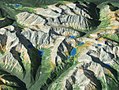 Tatry Mapa Plastyczna.JPG 700 × 525; 206 KB
-
 Tatry polskie szlaki turystyczne.png 3,462 × 1,869; 1.31 MB
-
 Tatry pov kat.png 2,336 × 1,652; 112 KB
-
 Tatry.jpg 1,250 × 600; 104 KB
-
 Test ShareMap Automatic Upload2.svg 800 × 442; 325 KB
-
 TEŽ+OŽ scheme.svg 1,002 × 452; 37 KB
-
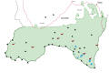 PL Tatra Montains National Park.svg 1,844 × 1,219; 70 KB
-
 Tátrai villamosvasút térképe.png 1,280 × 1,024; 53 KB
-
 Západné Tatry.jpg 801 × 496; 61 KB

_(20670533449).jpg)


