Category:Maps of the Taiwan Strait
Jump to navigation
Jump to search
Media in category "Maps of the Taiwan Strait"
The following 20 files are in this category, out of 20 total.
-
-
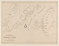
 Admiralty Chart No 1760 The Brothers to Ockseu Island, Published 1891.jpg 20,790 × 11,294; 67.52 MB
-

-
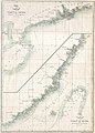
 Admiralty Chart No 1957 Hao-Wang Chiao to Hsiung-Ti Tao, Published 1934, New Edition 1954.jpg 16,381 × 11,301; 45.62 MB
-
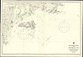
 Admiralty Chart No 1959 Wei-T'ou Ao and Shen-Hu Wan, Published 1849, Large Corrections 1954.jpg 8,247 × 11,259; 17.84 MB
-
 Admiralty Chart No 1968 Tai-Wan and Strait, Published 1966.jpg 16,365 × 11,235; 36.98 MB
-
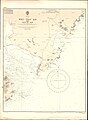
 Admiralty Chart No 1985 Hai-T'an Hsia, Published 1959.jpg 11,068 × 16,307; 53.55 MB
-

-
 Bathymetry and ocean currents of the Taiwan Strait and nearby areas.png 1,205 × 1,218; 687 KB
-
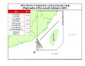 Flight paths of PLA aircraft, October 4, 2021.pdf 1,650 × 1,275; 65 KB
-
 Kaart van de Chineesche kust en van Formosa 1849.jpg 6,252 × 4,906; 2.21 MB
-
 Landform of Kinmen and Matsu.png 1,108 × 636; 66 KB
-
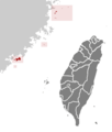 ROC Fuchien.png 362 × 425; 11 KB
-
 Surface-to-Air Missile Coverage over the Taiwan Strait-ar.png 596 × 599; 185 KB
-
 Surface-to-Air Missile Coverage over the Taiwan Strait.png 738 × 753; 104 KB
-
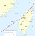
 Taiwan Strait Tunnel Project.png 957 × 585; 281 KB
-
 Taiwan Strait.png 681 × 800; 207 KB
-
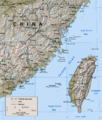
 TaixinanPendi.JPG 540 × 276; 29 KB
-
 台湾淺灘.png 1,309 × 873; 234 KB
-
 民國109年9月19日共軍侵犯中華民國防空識別區以及越過台海中線.png 1,218 × 897; 394 KB


