Category:Maps of the Roman Low Countries
Jump to navigation
Jump to search
For the purpose of this category, 'Roman Low Countries' will be considered the territories of the Low Countries (including those currently belonging to Belgium, the Netherlands, and Luxemburg (=Benelux), and the parts of northern France and western Germany that are historically grouped amongst the Low Countries) between the years 58 BCE and 500 CE. See also Category:Gallia Belgica and Category:Germania Inferior.
Media in category "Maps of the Roman Low Countries"
The following 36 files are in this category, out of 36 total.
-
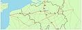
 Atuatuca.PNG 435 × 497; 257 KB
-
 Belgica1.png 200 × 134; 5 KB
-
 16 of '(Histoire de la Belgique.)' (11111017204).jpg 2,560 × 1,541; 868 KB
-

-

-

-
 31 of '(Histoire de la Belgique.)' (11110487834).jpg 2,560 × 1,541; 852 KB
-
 400 Germania I II Belgica I II.png 522 × 461; 263 KB
-
 A-3-37-58-Belgium.jpg 3,000 × 2,248; 928 KB
-
 Carte des peuples francs (IIIe siècle) hu.svg 1,704 × 1,751; 66 KB
-
 Carte des peuples francs (IIIe siècle) nl.svg 1,704 × 1,751; 331 KB
-
 Carte des peuples francs (IIIe siècle)-pt.svg 1,704 × 1,751; 63 KB
-
 Carte des peuples francs (IIIe siècle).svg 1,704 × 1,751; 473 KB
-
 Conquêtes de Clodion.png 1,395 × 1,056; 454 KB
-
 De Franken tussen 400 en 440 jp.svg 2,323 × 1,729; 660 KB
-
 De Franken tussen 400 en 440 nl.svg 2,323 × 1,729; 644 KB
-
 Franken Expans1.jpg 1,009 × 868; 250 KB
-
 Franken Expansion bis 6Jhdt.png 2,102 × 1,674; 856 KB
-
 Frankish Foederatus.png 570 × 471; 73 KB
-
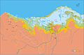
 Germania inferior roads towns.png 1,162 × 1,134; 1.83 MB
-
 Kaart heirwegen elewijt 2.jpg 665 × 246; 49 KB
-
 Les Francs en Belgique romaine-de.svg 1,280 × 883; 553 KB
-
 Les Francs en Belgique romaine-es.svg 1,280 × 883; 382 KB
-
 Les Francs en Belgique romaine-pt.svg 1,280 × 883; 35 KB
-
 Les Francs en Belgique romaine-ru.svg 1,280 × 883; 62 KB
-
 Les Francs en Belgique romaine.svg 1,280 × 883; 353 KB
-
 Les Francs entre 400 et 440-es.svg 2,323 × 1,729; 355 KB
-
 Les Francs entre 400 et 440-pt.svg 2,323 × 1,729; 62 KB
-
 Les Francs entre 400 et 440.svg 2,323 × 1,729; 430 KB
-
 Mitteleuropa BV042518609.jpg 1,012 × 1,178; 163 KB
-

-

-
 Roman roads Atuatuca noviomagus.png 645 × 568; 539 KB
-
 Spruner-Menke Handatlas 1880 Karte 31.jpg 10,439 × 8,713; 14.93 MB
-
 Transgression marine rive Est de la Mer du Nord (de 250 à 600).jpg 600 × 389; 26 KB
-
 Cartes generales de toutes les parties du monde 1681 (127474737).jpg 13,969 × 9,361; 16.63 MB


%27_(11111017204).jpg)
.jpg)
.jpg)
_(14741857236).jpg)
%27_(11110487834).jpg)


_hu.svg)
_nl.svg)
-pt.svg)
.svg)


.jpg)
.jpg)


.jpg)
.jpg)