Category:Maps of the Principality of Achaea
Jump to navigation
Jump to search
Media in category "Maps of the Principality of Achaea"
The following 15 files are in this category, out of 15 total.
-
 Balkan and Byzantium in 1265-SR (Serbian).svg 1,822 × 870; 600 KB
-
 ByzantineEmpire1265-es.svg 1,708 × 816; 611 KB
-
 ByzantineEmpire1265-sr.svg 1,708 × 816; 556 KB
-
 ByzantineEmpire1265.svg 1,708 × 816; 479 KB
-
 ByzantinischesReich 1265-hu.svg 1,708 × 816; 557 KB
-
 Duché Naxos.png 730 × 600; 111 KB
-
 Glarentza1.png 684 × 552; 35 KB
-
 Greece in 1210V1.svg 3,509 × 2,000; 1.38 MB
-
 Greece in 1214.JPG 1,732 × 1,104; 669 KB
-
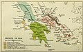
 Greece in 1278.JPG 1,312 × 1,131; 163 KB
-
 LatinEmpire-fr.png 2,941 × 1,631; 1.01 MB
-
 LatinEmpire-fr.svg 2,759 × 1,532; 2.71 MB
-
 Map of the southern Balkans, 1410-es.svg 2,217 × 1,959; 2.76 MB
-
 Map of the southern Balkans, 1410.svg 2,217 × 1,959; 2.56 MB
-
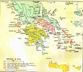
 Principality of Achaea in 1278.jpg 832 × 749; 215 KB
.svg)


