Category:Maps of the Pearl River Delta
Jump to navigation
Jump to search
Media in category "Maps of the Pearl River Delta"
The following 45 files are in this category, out of 45 total.
-
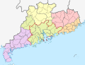
 Geography of Guangdong.gif 427 × 334; 9 KB
-
 BOELEN(1836) T3 p218 DE RIVIER TIGRIS AN DE STAD CANTON.jpg 4,789 × 2,143; 4.92 MB
-
 BOELEN(1836) T3 p286 SCHETS VAN DE HAVEN VAN MACAO.jpg 2,004 × 2,525; 2.45 MB
-
 520 of 'A Voyage round the World' (11010092553).jpg 2,368 × 3,132; 1.2 MB
-
 9-2 Map.png 542 × 410; 82 KB
-
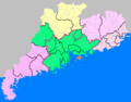
 Administrative Division Foshan.png 1,900 × 1,900; 455 KB
-
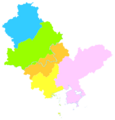 Administrative Division Huizhou.png 840 × 880; 91 KB
-
 Administrative Division Jiangmen.png 800 × 880; 119 KB
-
 Admiralty Chart Catalogue 1967 Page 067 Index J3.jpg 8,571 × 6,824; 9.06 MB
-
 Admiralty Chart No 1263 Entrance to the Canton River, Published 1840.jpg 15,068 × 11,389; 18.94 MB
-

-
 AMH-7965-KB Map of the mouth of the Canton River (cropped).jpg 1,752 × 2,336; 858 KB
-
 AMH-7965-KB Map of the mouth of the Canton River.jpg 1,846 × 2,400; 891 KB
-
 Canton estuary 2.jpg 3,595 × 3,181; 6.81 MB
-
 Canton estuary.jpg 3,595 × 3,181; 1.14 MB
-
 Canton Harbor.png 720 × 720; 62 KB
-
 CANTON RIVER AND ADJACENT ISLANDS from Google Book.jpg 4,887 × 4,661; 2.24 MB
-
 CANTON RIVER AND ADJACENT ISLANDS, 2nd ed.jpg 2,468 × 2,355; 963 KB
-
 Canton River and adjacent islands.jpg 4,952 × 4,695; 5.44 MB
-
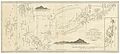
 Canton to Bocca Tigris.jpg 2,580 × 1,442; 1.69 MB
-
 Chart of the Canton River.jpg 2,484 × 2,324; 264 KB
-
 D559- N° 411. La rivière de Canton et Macao. - liv3-ch14.png 980 × 1,502; 114 KB
-
-

-
 Die Chinesische Küste Der Provinz Kuang-tung.jpg 11,855 × 8,522; 14.87 MB
-
 Du Halde - Description de la Chine - Carte de l entree de Canton.jpg 1,755 × 2,764; 952 KB
-
 Geography of Guangdong.svg 1,148 × 881; 342 KB
-
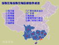
 Guangdong–Hong Kong–Macau Greater Bay Area.png 2,623 × 1,955; 725 KB
-
 HK CAN MO 1945.jpg 10,096 × 7,984; 12.13 MB
-
 Map of Canton River.jpg 1,732 × 1,509; 266 KB
-
-
 Maps Kwangtung Pearl River Delta.tif 3,518 × 2,666; 26.86 MB
-
 Pearl River Delta Area-ar.png 1,000 × 800; 175 KB
-
 Pearl River Delta Area.png 1,000 × 800; 182 KB
-
 Pearl River Entrance 1922.jpg 13,216 × 12,000; 18.01 MB
-
 Pearl River Entrance 1940.jpg 18,720 × 18,624; 58.43 MB
-
 Pearl River sketch.jpg 1,131 × 1,672; 1.14 MB
-
 Plan de la Ville et du Port de Macao.jpg 950 × 1,180; 1.13 MB
-
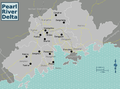 PRD.png 2,623 × 1,955; 778 KB
-
 River and Port of Canton.jpg 1,841 × 1,027; 261 KB
-
 Sanon.png 649 × 530; 758 KB
-
 Situationskärtchen von Kanton, Makao, Hongkong.jpg 966 × 1,233; 207 KB
-
 Survey of Canton River.jpg 2,143 × 1,507; 3.25 MB
-
 The Macao - Bocca Tigris - Canton approach.jpg 898 × 1,046; 773 KB
-
 Ville et Port de Macao.png 870 × 970; 1.86 MB

_T3_p218_DE_RIVIER_TIGRIS_AN_DE_STAD_CANTON.jpg)
_T3_p286_SCHETS_VAN_DE_HAVEN_VAN_MACAO.jpg)
.jpg)


_Chu_Kiang_or_Canton_River_--_Kap_Shui_Mun_to_Boca_Tigris_(Southern_Sheet),_Published_1914,_Corrections_to_1949.jpg)
.jpg)


