Category:Maps of the Ottoman Empire in the 20th century
Jump to navigation
Jump to search
English: This category is about history maps on the subject. Old maps belong into: Category:20th-century maps of the Ottoman Empire and its subcategories.
Subcategories
This category has the following 5 subcategories, out of 5 total.
Media in category "Maps of the Ottoman Empire in the 20th century"
The following 8 files are in this category, out of 8 total.
-
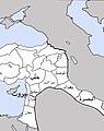 Osman Taksim.jpg 521 × 656; 72 KB
-
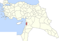
 Hejaz Vilayet.png 366 × 357; 48 KB
-
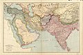 Map by Edward Stanford.jpg 3,999 × 2,664; 3.17 MB
-
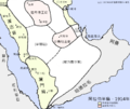 Arabia 1914 (zh-hant).png 887 × 747; 332 KB
-
 Partition of Ottoman Empire Map.png 2,344 × 1,080; 92 KB
-
 Sanjak of Tripoli Ottoman Empire, 1914.png 1,200 × 836; 230 KB
-
 Treaty of Sèvres 1920.svg 1,270 × 765; 503 KB
-


.png)


.jpg)