Category:Maps of the Mystic River
Jump to navigation
Jump to search
Media in category "Maps of the Mystic River"
The following 11 files are in this category, out of 11 total.
-

-

-
-

-
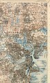
 Atlas of the city of Boston - Charlestown - plate 4 (19866042805).jpg 2,000 × 1,342; 2.73 MB
-
 Charlesrivermap.png 1,000 × 1,000; 587 KB
-
 Mystic River (Massachusetts) map.jpg 1,700 × 2,800; 2.58 MB
-
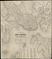
 Plan of Charlestown (3855695619).jpg 2,000 × 1,341; 2.18 MB
-
 Plan of part of Mystic River, with common low water mark of line of flats (2675201136).jpg 2,000 × 1,281; 2.24 MB
-
 Plan of real estate in Charlestown, showing park laid out (3856497224).jpg 2,000 × 1,422; 2.22 MB
-
 The Medford historical register (1898) (14577226777).jpg 2,328 × 3,540; 536 KB


.jpg)

.jpg)

_map.jpg)
.jpg)
.jpg)
.jpg)
_(14577226777).jpg)