English: Maps of the region La Libertad in Peru
<nowiki>Category:Maps of the La Libertad Region; categoría de Wikimedia; kategori Wikimedia; Wikimedia category; د ويکيمېډيا وېشنيزه; Vikimedya kategorisi; ویکیمیڈیا زمرہ; kategória projektov Wikimedia; категорія проєкту Вікімедіа; 维基媒体分类; Wikimedia-Kategorie; Викимедиина категорија; kategorija na Wikimediji; विकिपीडिया:श्रेणी; page de catégorie de Wikimedia; kategorija na Wikimediji; विकिपीडिया वर्ग; категорија на Викимедији; Wikimedia-Kategorie; Wikimedia-kategori; kategori Wikimédia; تصنيف ويكيميديا; pajenn rummata eus Wikimedia; Wikimedia:ကဏ္ဍခွဲခြင်း; 維基媒體分類; Wikimedia категориясы; categoría de Wikimedia; Wikimedia-Kategorie; Wikimedia-Kategorie; tudalen categori Wikimedia; kategori e Wikimedias; Վիքիմեդիայի նախագծի կատեգորիա; 维基媒体分类; Wikimedia-kategori; ვიკიპედია:კატეგორიზაცია; ウィキメディアのカテゴリ; categoria Wikimedia; تصنيف بتاع ويكيميديا; විකිමීඩියා ප්රභේද පිටුව; categoria Vicimediorum; Vikipidiya:Shopni; Wikimedia-luokka; Wikimedia category; guruhi Vikimedia; катэгорыя ў праекце Вікімэдыя; Викимедиа проектындагы төркем; catigurìa di nu pruggettu Wikimedia; หน้าหมวดหมู่วิกิมีเดีย; Wikimedia:Kategorija; Wikimedia-Kategorie; Wikimedia:Klassys; категория на Уикимедия; categorie a unui proiect Wikimedia; 維基媒體分類; Wikimedia-kategori; kawan Wikimèdia; 維基媒體分類; 위키미디어 분류; Wikimedia-bólkur; kategorio en Vikimedio; kategori Wikimedia; categoría de Wikimedia; উইকিমিডিয়া বিষয়শ্রেণী; kategori Wikimedia; 维基媒体分类; וויקימעדיע קאַטעגאָריע; kategorija w projektach Wikimedije; thể loại Wikimedia; Wikimedia projekta kategorija; Wikimedia-kategorie; categoria de um projeto da Wikimedia; 维基媒体分类; категорияд Ангилал; Wikimedia-kategori; kategori Wikimedia; پۆلی ویکیمیدیا; Wikimedia category; Vikimédia ñemohenda; Wikimédia-kategória; વિકિપીડિયા શ્રેણી; Wikimediako kategoria; категория в проекте Викимедиа; Wikimedia-Kategorie; катэгорыя ў праекце Вікімедыя; Wikimedia-kategorie; Wîkîmediya:Kategorî; विकिमिडिया श्रेणी; Wikimedia-Kategorie; קטגוריה במיזמי ויקימדיה; Викимедиа проектындагы төркем; 维基媒体分类; विकिमिडिया श्रेणी; Wikimedia-categorie; Wikimedia-kategoriija; гурӯҳи Викимедиа; 維基媒體分類; Wikimedia:Ronnaghys; Wikimedia-kategory; categoria di un progetto Wikimedia; Wikimedia category; jamii ya Wikimedia; Viciméid catagóir; Wikimedia kategooria; categurìa 'e nu pruggette Wikimedia; ردهٔ ویکیپدیا; Викимедиа категорияһы; Wikimedia proyektındağı törkem; ẹ̀ka Wikimedia; гурӯҳи Викимедиа; categoria de um projeto da Wikimedia; kategorie na projektech Wikimedia; Wikimedia-Kategorie; tumbung Wikimedia; Wikimedia-categorie; kategorija Wikimedie; kategorya ng Wikimedia; kategoria ti Wikimedia; விக்கிமீடியப் பகுப்பு; kategori Wikimedia; kategoria w projekcie Wikimedia; വിക്കിമീഡിയ വർഗ്ഗം; 維基媒體分類; kategori Wikimedia; categoria de Wikimedia; زمرو:وڪيپيڊيا زمرا بندي; विकिमीडिया श्रेणी; categoría de Wikimedia; Wikimedia-categorie; κατηγορία εγχειρημάτων Wikimedia; Kategoriya ning Wikimedia</nowiki>
Subcategories
This category has the following 5 subcategories, out of 5 total.


.svg)

 Dibujohhhh.JPG 365 × 545; 38 KB
 División Politica de La Libertad.jpg 767 × 524; 68 KB
 Flag Map of La Libertad.png 4,297 × 3,135; 767 KB
 Flag map of provinces of La Libertad.png 4,297 × 3,135; 795 KB
 La Libertad Districts map 4000px~.svg 4,426 × 3,219; 1.77 MB
 La Libertad.png 1,276 × 934; 656 KB
 Mapa de les huaques del sol i de la lluna i altres ruïnes.jpg 3,968 × 2,976; 1.89 MB
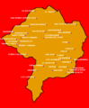 MAPA DEL DISTRITO DE QUIRUVILCA.png 700 × 852; 2.28 MB
 Mapa Sistema vial Chugay.jpg 3,739 × 4,579; 2.02 MB
 Mapa-de-Curgos.png 518 × 630; 57 KB
 Mapachilia2010.jpg 279 × 367; 27 KB
 MFPS-D-lalibertad.jpg 5,390 × 6,804; 5.85 MB
 Map of La Libertad region.PNG 370 × 302; 11 KB
 Provinciasdelnortegrande-peru.png 663 × 761; 42 KB
 ValleDeMoche.JPG 1,215 × 857; 551 KB
 Wireframe La Libertad(Peru) districts.svg 2,560 × 1,855; 1.17 MB


_districts.svg)