Category:Maps of the Khmer Empire
Jump to navigation
Jump to search
Media in category "Maps of the Khmer Empire"
The following 34 files are in this category, out of 34 total.
-
 1970 Khmer Empire (30583780310).jpg 3,112 × 4,122; 12.83 MB
-
 Asia in 1335 cn en.png 866 × 394; 123 KB
-
 Asia in 1345.svg 1,100 × 837; 1.02 MB
-
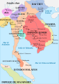
 Bản đồ Việt Nam thời Lý năm 1085.png 2,000 × 2,281; 382 KB
-
 Cambòtja - Empèri Khmer dins lo corrent dau sègle XII.png 840 × 828; 181 KB
-
 Carte Empire-Khmer.png 435 × 445; 33 KB
-
 Chien tranh dong nam a tram nam.jpg 1,300 × 1,752; 1.11 MB
-
 Indochina 1300 CE.png 628 × 717; 150 KB
-
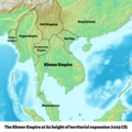 Khmer Empire 1203 Map.png 1,800 × 1,800; 2.7 MB
-
 Khmer Empire Expansion (cropped).png 2,377 × 1,419; 442 KB
-
 Khmer Empire Expansion (cropped1).png 1,956 × 1,419; 415 KB
-
 Khmer Empire Expansion.png 2,377 × 1,665; 565 KB
-
 Khmer Empire1.png 271 × 263; 12 KB
-
 Khmer Map Phnom Penh 0558.jpg 1,944 × 2,592; 2.71 MB
-
 Khmer.2.jpg 271 × 263; 8 KB
-
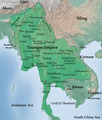 Map of Taungoo Empire (1580).png 950 × 1,121; 1.5 MB
-
 Map-of-southeast-asia 1000 - 1100 CE-es.svg 744 × 1,047; 944 KB
-
 Map-of-southeast-asia 1000 - 1100 CE.png 791 × 1,114; 162 KB
-
 Map-of-southeast-asia 1300 CE-es.svg 744 × 1,047; 1,015 KB
-
 Map-of-southeast-asia 1300 CE.png 800 × 1,125; 251 KB
-
 Map-of-southeast-asia 1400 CE-es.svg 791 × 1,114; 535 KB
-
 Map-of-southeast-asia 1400 CE.png 791 × 1,114; 190 KB
-
 Map-of-southeast-asia 900 CE-es.svg 744 × 1,047; 679 KB
-
 Map-of-southeast-asia 900 CE-hu.svg 791 × 1,114; 131 KB
-
 Map-of-southeast-asia 900 CE-ko.svg 791 × 1,114; 127 KB
-
 Map-of-southeast-asia 900 CE.png 791 × 1,114; 182 KB
-
 Map-of-southeast-asia 900 CE.svg 791 × 1,114; 124 KB
-
 Mappa Impero Khmer (it).svg 791 × 1,114; 133 KB
-
 Mappa Impero Khmer.png 791 × 1,114; 144 KB
-
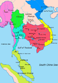
 Southeast Asian history - 13th century (Thai language).png 840 × 1,280; 416 KB
-
 Southeast Asian history - 13th century-es.svg 709 × 872; 1.23 MB
-
 Southeast Asian history - 13th century.png 753 × 1,147; 159 KB
-
 Vietnam1650.GIF 428 × 713; 15 KB
-
 VietnamMac1540.gif 428 × 713; 14 KB
.jpg)


.png)
.png)


.png)


.svg)

.png)


