Category:Maps of the Guiana Shield
Jump to navigation
Jump to search
Media in category "Maps of the Guiana Shield"
The following 16 files are in this category, out of 16 total.
-
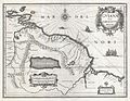 1635 Blaeu Map Guiana, Venezuela, and El Dorado - Geographicus - Guiana-blaeu-1635.jpg 4,000 × 3,084; 3.51 MB
-
 Amazonaskarte Bry 1599.jpg 1,982 × 1,489; 1.43 MB
-
 Guiana shield map-es.svg 3,123 × 2,523; 1,009 KB
-
 Guiana shield map-fr.svg 3,123 × 2,523; 1.03 MB
-
 Guiana shield map-mk.svg 3,123 × 2,523; 1.02 MB
-
 Bouclier guyanais.svg 1,500 × 1,200; 59 KB
-
 Guiana.Shield.en.svg 1,500 × 1,200; 59 KB
-
 Guiana.Shield.he.svg 1,500 × 1,200; 60 KB
-
 Escudo guyanés.svg 1,500 × 1,080; 51 KB
-
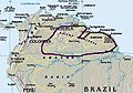 Guyana Shield.jpg 338 × 238; 29 KB
-
 HooglandGuyana.png 852 × 455; 438 KB
-
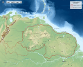
 Map of the Guiana Shield Neutral Borders.png 900 × 648; 748 KB
-
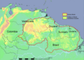
 Map of the Guiana shield.png 900 × 648; 789 KB
-
 Map of the Guiana Shield.svg 480 × 330; 607 KB
-

-
 Summits of the Guiana Highlands.png 638 × 510; 67 KB


