Category:Maps of the Greek colonies in Crimea
Jump to navigation
Jump to search
Media in category "Maps of the Greek colonies in Crimea"
The following 28 files are in this category, out of 28 total.
-
-
 Ancient Greek Colonies of N Black Sea el.png 1,301 × 818; 258 KB
-
 Ancient Greek Colonies of N Black Sea ln.png 1,301 × 818; 131 KB
-
 Ancient Greek Colonies of N Black Sea.png 1,289 × 806; 294 KB
-
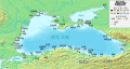
 AncientGreekColoniesofBlackSea.png 800 × 503; 227 KB
-

-

-
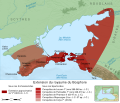
 Bosporan Kingdom growth map-es.svg 675 × 575; 2.21 MB
-
 Bosporan Kingdom growth map-fr.svg 675 × 575; 1.13 MB
-
 Bosporan Kingdom growth map-pt.svg 675 × 575; 752 KB
-
 Greek colonies of the Euxine Sea-pt.svg 1,280 × 684; 346 KB
-
 Greek colonies of the Euxine Sea-zh.svg 1,280 × 684; 361 KB
-
 Greek colonies of the Euxine Sea.svg 1,280 × 684; 349 KB
-
 Greek colonies of the Northern Euxine Sea (Black Sea)-pt.svg 1,142 × 424; 314 KB
-
 Greek colonies of the Northern Euxine Sea (Black Sea).svg 1,142 × 424; 289 KB
-
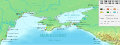
 Map ancient Greek colonies in northern Black Sea-en.svg 1,043 × 756; 2.15 MB
-
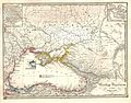
 Map ancient Greek colonies in northern Black Sea-es.jpg 1,043 × 756; 144 KB
-
 Map ancient Greek colonies in northern Black Sea-es.svg 1,043 × 696; 13.2 MB
-
 Map ancient Greek colonies in northern Black Sea-fr.svg 1,043 × 696; 1.83 MB
-
 Map ancient Greek colonies in northern Black Sea-pt.svg 1,043 × 756; 1.95 MB
-
 Map ancient Greek colonies in northern Black Sea-ru.svg 1,043 × 756; 2.21 MB
-
 Pontos Euxeinos.gif 670 × 488; 56 KB
-
 PontosGreekColonies.jpg 1,160 × 760; 165 KB
-
-

-
 Towns Bosporan Kingdom hu.svg 425 × 349; 75 KB
-
 Towns Bosporan Kingdom.png 425 × 349; 22 KB
-
 Ελληνικές αποικίες Ευξείνου Πόντου.svg 1,280 × 684; 350 KB


.jpg)
.jpg)


-pt.svg)
.svg)