Category:Maps of the Grand Principality of Serbia
Jump to navigation
Jump to search
Media in category "Maps of the Grand Principality of Serbia"
The following 28 files are in this category, out of 28 total.
-
 Blank map Serbia Stefana Nemanje.svg 1,334 × 1,088; 7 KB
-
 Drzava Stefana Nemanje XII vijek.svg 1,334 × 1,088; 29 KB
-
 Drzava Stefana Nemanje.jpg 1,066 × 862; 84 KB
-
 Drzava stefana nemanje.png 995 × 591; 83 KB
-
 Europe 1142.jpg 1,327 × 959; 536 KB
-
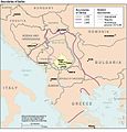
 First.Crusade.Map.jpg 1,730 × 1,402; 730 KB
-
 Map of the Principality of Serbia, 12th century.png 500 × 400; 34 KB
-
 Osvajanja Stefana Nemanje (1183-1187).png 1,500 × 1,336; 410 KB
-
 Public Schools Historical Atlas - Europe 1135.jpg 2,234 × 1,734; 1,013 KB
-
 Serbia boundaries CIA.jpg 655 × 686; 103 KB
-
 Serbia Nemanii 1184 pl.png 545 × 602; 133 KB
-
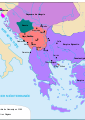
 Serbia under Stefan Nemanja and Stefan the First-Crowned.jpg 733 × 600; 137 KB
-
 Serbie de Nemanja 1184 sr.svg 994 × 1,104; 296 KB
-
 Serbie de Nemanja 1184-hu.svg 994 × 1,104; 278 KB
-
 Serbie de Nemanja 1184.svg 994 × 1,104; 48 KB
-
 Serbie de Nemanja.svg 744 × 1,052; 348 KB
-
 Serbie de Stefan1er Nemanjic-es.svg 994 × 1,104; 1.1 MB
-
 Serbie de Stefan1er Nemanjic-pt.svg 994 × 1,104; 104 KB
-
 Serbie de Stefan1er Nemanjic.svg 994 × 1,104; 280 KB
-
 Srbija St Nemanje kraj XII v-es.svg 1,349 × 1,096; 358 KB
-
 Srbija St Nemanje kraj XII v.svg 1,349 × 1,096; 332 KB
-
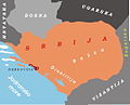
 Srbija Stefana Nemanje kraj XII v.jpg 1,066 × 871; 169 KB
-
 Srbija Stefana Nemanje.jpg 1,069 × 865; 167 KB
-
 Srbsko XII es.svg 2,415 × 2,000; 594 KB
-
 Srbsko XII ru.svg 420 × 341; 270 KB
-
 Stefan Nemanja Serbia XII c AD.jpg 1,067 × 870; 145 KB
-
 Освајања Стефана Немање.png 1,500 × 1,336; 410 KB
-
 Српске државе половином 12.png 853 × 677; 135 KB


.png)


