Category:Maps of the French and Indian War
Jump to navigation
Jump to search
Subcategories
This category has only the following subcategory.
Media in category "Maps of the French and Indian War"
The following 66 files are in this category, out of 66 total.
-

-
-

-
-

-
 1754 French and Indian War.png 6,734 × 4,320; 609 KB
-

-
 A history of Pennsylvania (1913) (14597315100).jpg 2,748 × 1,664; 811 KB
-

-

-

-
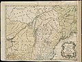 A new and accurate map of the present war in North America (4231162161).jpg 2,000 × 1,506; 3 MB
-

-

-
 A plan of the encampment of the detachment from the little Meadows (18347935635).jpg 1,464 × 2,000; 2.04 MB
-
 A plan of the line of march of the detachment from the little Meadows (18347935255).jpg 1,470 × 2,000; 1.99 MB
-
 A plan of the line of march with the whole baggage (18160082048).jpg 1,470 × 2,000; 2.01 MB
-

-
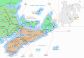 Acadia 1754 map.svg 1,573 × 1,100; 572 KB
-
 Acadia 1754-es.svg 1,573 × 1,260; 1.22 MB
-
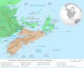
 Acadia 1754.png 2,360 × 1,650; 1.25 MB
-
 Acadia 1754.svg 1,573 × 1,260; 592 KB
-
 Acadie 1754 carte.svg 1,573 × 1,100; 576 KB
-
 Acadie 1754.png 2,360 × 1,650; 1.28 MB
-
 Acadie 1754.svg 1,573 × 1,260; 597 KB
-
 Beaubassin1755.jpg 4,434 × 3,366; 4.53 MB
-
 Braddock 1755.jpg 907 × 726; 156 KB
-
 Braddock Expedition - ru.svg 1,367 × 1,011; 2.13 MB
-
 Carte du siège du fort William Henry en 1757.jpg 953 × 1,449; 788 KB
-
 Carte Guerre de 7 ans Amérique du nord.PNG 1,120 × 853; 92 KB
-
 Carte Guerre de 7 ans Amérique du nord2.PNG 1,120 × 853; 104 KB
-
 Cumberland md braddock road.jpg 2,136 × 988; 601 KB
-
 233 of 'The History of Canada' (11197659086).jpg 1,459 × 2,486; 536 KB
-
 Fort frontenac.jpg 1,312 × 1,569; 1.15 MB
-
 French and indian war map-es.svg 2,797 × 2,000; 1.13 MB
-
 French and Indian War map.png 2,128 × 2,274; 858 KB
-
 French and indian war map.svg 745 × 533; 1.38 MB
-
 French and Indian War.png 764 × 972; 503 KB
-
 French British Forts 1753 1758.jpg 813 × 549; 116 KB
-
 French British Forts 1753 1758.png 328 × 423; 32 KB
-

-

-
 George Washington's map, accompanying his "journal to the Ohio", 1754. LOC 99446116.jpg 4,743 × 6,136; 3.76 MB
-
 Guerre de la Conquête (1754 - 1763)-fr.svg 745 × 533; 599 KB
-
 Guèrra de Sèt Ans (1756-1763) - Teatre d'America dau Nòrd.png 587 × 627; 174 KB
-
 Karte - Gefechte in Nordamerika 1754.png 463 × 802; 76 KB
-
 La vallée de l'Ohio et ses forts en 1755.jpg 1,438 × 959; 638 KB
-
 Map of the Country about the Mississippi, Circa 1755 WDL9587.png 1,729 × 1,024; 2.66 MB
-
-
 MontresorChaudiereMap1760.jpg 4,618 × 5,510; 3.16 MB
-
 MontresorChaudiereMap1760HeightOfLand.jpg 960 × 1,212; 370 KB
-
 NorthAmerica1762-83-ar.png 787 × 600; 114 KB
-
 NorthAmerica1762-83.png 787 × 600; 90 KB
-
 NorthAmerica1763-A.png 787 × 600; 43 KB
-
 Nps1753-54-de.png 2,446 × 1,144; 1.65 MB
-
 Nps1753-54.png 2,446 × 1,144; 1.84 MB
-

-

-

-
 SiegeOfLouisbourg1758.jpg 1,334 × 900; 311 KB
-

-
 The magazine of American history with notes and queries (1877) (14781654251).jpg 3,408 × 2,284; 1.28 MB
-

-
 Washington Pennsylvania Map.jpg 4,743 × 6,136; 15.91 MB
-
 Washington Pennsylvania Mapb.jpg 4,549 × 5,742; 12 MB
-
 Wojna 7-letnia w ameryce.svg 745 × 533; 1.9 MB
)%27_(11181956496).jpg)
.jpg)
.jpg)
_hung_on_a_horn%27_(11211564646).jpg)
_hung_on_a_horn%27_(11208682986).jpg)

_(14780250104).jpg)
_(14597315100).jpg)
_(14761815504).jpg)
.jpg)
.jpg)
.jpg)
.jpg)
.jpg)
.jpg)
.jpg)
.jpg)
.jpg)


.jpg)


-fr.svg)
_-_Teatre_d%27America_dau_N%C3%B2rd.png)


.jpg)


_(14781654251).jpg)


.jpg)