Category:Maps of the East Midlands
Jump to navigation
Jump to search
Subcategories
This category has the following 11 subcategories, out of 11 total.
D
F
L
N
O
P
R
Media in category "Maps of the East Midlands"
The following 23 files are in this category, out of 23 total.
-
 DN postcode map.png 1,136 × 717; 36 KB
-
 East and West Midlands in the United Kingdom location map.svg 871 × 1,289; 2.23 MB
-
 East Midlands constituencies 2011 map.svg 1,099 × 1,305; 1.66 MB
-
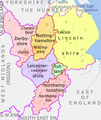 East Midlands counties 00.png 1,723 × 2,047; 295 KB
-
 East Midlands counties 2009 map.svg 1,099 × 1,305; 1.66 MB
-
 East Midlands counties 2021 map.svg 1,099 × 1,305; 1.65 MB
-
 East Midlands districts 2011 map.svg 1,099 × 1,305; 1.61 MB
-
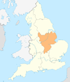 East Midlands in England.png 814 × 953; 107 KB
-
 East Midlands in England.svg 816 × 991; 996 KB
-
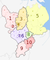
 East Midlands Mayor Councils.svg 417 × 429; 286 KB
-
 East Midlands wards 2011 map coloured.svg 1,099 × 1,305; 4.6 MB
-
 East Midlands wards 2011 map.svg 1,099 × 1,305; 4.59 MB
-
 East Midlands wards 2012 map.svg 1,099 × 1,305; 4.55 MB
-
 England Region - East Midlands.svg 525 × 650; 83 KB
-
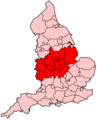
 EnglandEastMidlands.png 200 × 247; 15 KB
-
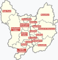
 EnglandEastMidlandsNumbered.png 200 × 230; 23 KB
-
 EnglandGovernmentMidlands.png 2,165 × 2,670; 100 KB
-
 EnglishSouthMidlandsCountiesMap.png 625 × 569; 27 KB
-
 Ministry of Defence Series 1404 sheet 171-C Birmingham, published 1967.jpg 6,936 × 5,430; 10.81 MB
-
 NUTS 3 regions of the East Midlands 2010 map.svg 1,099 × 1,305; 1.64 MB
-
 NUTS 3 regions of the East Midlands map.svg 1,099 × 1,305; 1.63 MB
-
 Ordnance Survey Quarter-inch sheet 11 North Midlands and Yorkshire, published 1964.jpg 9,601 × 8,904; 10.65 MB
-
 United Kingdom AV referendum East Midlands results.svg 1,099 × 1,305; 1.61 MB


