Category:Maps of the Dutch Republic
Jump to navigation
Jump to search
Media in category "Maps of the Dutch Republic"
The following 17 files are in this category, out of 17 total.
-
 "Belgica Foederata" (22069021338).jpg 3,635 × 3,067; 2.72 MB
-
 335 years war locations.png 250 × 115; 5 KB
-
 Belgium as a Lion WDL2685.png 1,331 × 1,024; 3.14 MB
-
 Bor-Nederlantsche-Oorloghen 9139.tif 4,902 × 3,558; 49.94 MB
-
 Dutch republic Bul Map 1648.png 4,090 × 4,500; 789 KB
-
 DutchRepublic.PNG 250 × 115; 5 KB
-
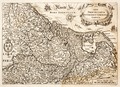
 Emanuel van Meteren Historie ppn 051504510 Landkaart Nederland Noord-Frankrijk MG 8638.tif 4,638 × 3,678; 48.84 MB
-
-
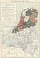 Northern Netherlands map 002.jpg 1,320 × 1,919; 556 KB
-
 Northern Netherlands map 003.jpg 553 × 820; 106 KB
-
 Republic of the Seven United Netherlands (1789).svg 450 × 456; 800 KB
-
 Republiek der Zeven Verenigde Nederlanden de.svg 764 × 807; 429 KB
-
 Republiek der Zeven Verenigde Nederlanden es.svg 764 × 807; 755 KB
-
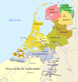
 Republiek der Zeven Verenigde Nederlanden.svg 2,870 × 3,250; 1.11 MB
-
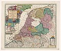
 Seven United Netherlands Janssonius 1658.jpg 5,543 × 4,782; 14.63 MB
-
 Southern Netherlands map 002.jpg 1,320 × 1,919; 580 KB
-

.jpg)


,_RP-P-AO-1-51B.jpg)


.svg)


