Category:Maps of the Durrani Empire
Jump to navigation
Jump to search
Media in category "Maps of the Durrani Empire"
The following 13 files are in this category, out of 13 total.
-
 Afgempdur.jpg 364 × 359; 109 KB
-
 Afghanistan unter Ahmad Schah Durrani.PNG 364 × 359; 60 KB
-
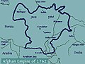
 Alleged extent of Durrani Empire 1762.jpg 345 × 284; 28 KB
-
 Durrani Empire (greatest extent).svg 553 × 553; 271 KB
-
 Durrani Empire 1747 1862 AD 2.png 620 × 429; 23 KB
-
 Durrani Empire 1747 1862 AD.png 832 × 650; 105 KB
-
 Durrani Empire 1762.jpg 461 × 350; 38 KB
-
 DurraniEmpireatitsgreatestextent.jpg 364 × 359; 108 KB
-
 Extent of Durrani Empire.png 364 × 359; 100 KB
-
 Flag map of the Durrani Empire.png 772 × 572; 57 KB
-
 Map of the Durrani Empire.png 3,196 × 1,840; 13.19 MB
-
 Mapofiran1756.png 3,415 × 2,987; 738 KB
-
 Mapofkhorasan1775.png 1,952 × 2,144; 258 KB


.svg)


