Category:Maps of the Demilitarized Zone of Korea
Jump to navigation
Jump to search
See also : Category:Conflicts by country
| Ongoing armed conflicts ( Countries Maps ) |
|---|
|
National or regional Maps of ongoing insurgencies, armed conflicts, disputes of territories, military conflicts, and also current civil or international wars :
See also:
Category:Conflicts in 2024 (with list of countries in ongoing armed conflicts) Template:City maps of ongoing civil wars (Local maps) |


.svg)

.png)


.svg)


.svg)


Subcategories
This category has only the following subcategory.
Media in category "Maps of the Demilitarized Zone of Korea"
The following 15 files are in this category, out of 15 total.
-
 'DMZ평화의 길' 철원 구간.png 575 × 449; 175 KB
-
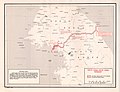
 6.25전쟁 전후 남북한 영토 변화.png 1,000 × 750; 203 KB
-
 Demilitarized Zone of Korea 04.JPG 3,488 × 2,616; 2.09 MB
-
 Demilitarized Zone of Korea 06.JPG 3,488 × 2,616; 2.09 MB
-
 Demilitarized Zone of Korea 15.JPG 2,616 × 3,488; 2.13 MB
-
 DMZ JOINT SECURITY AREA KAESONG CITY DPRK NORTH KOREA OCT 2012 (8643149352).jpg 4,883 × 3,066; 9.94 MB
-
 DMZ units.jpg 500 × 347; 39 KB
-
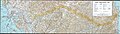 Korea demilitarized zone map - 1969.jpg 11,456 × 3,226; 13.25 MB
-
 Korean DMZ.jpg 1,007 × 769; 193 KB
-
 Map of Joint Security Area.svg 1,983 × 1,471; 577 KB
-
 Naval border islands between South Korea and North Korea.svg 912 × 653; 683 KB
-
 NJ-52.jpg 4,757 × 5,140; 6.45 MB
-

-

-
 The Korean Peninsula- Demilitarized Zone Area - DPLA - 5db5cdd85863984722e565b7ffcd80f7.jpg 2,554 × 3,280; 4.54 MB


.jpg)


.jpg)
.jpg)
