Category:Maps of the Congress Poland
Jump to navigation
Jump to search
Subcategories
This category has the following 2 subcategories, out of 2 total.
*
J
- January Uprising maps (13 F)
Media in category "Maps of the Congress Poland"
The following 44 files are in this category, out of 44 total.
-
 Congress Poland & Polish-Lithuanian Commonwealth (superimposed).png 1,900 × 1,554; 1.12 MB
-
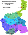
 Administrative division of Congress Poland in 1830.PNG 750 × 934; 67 KB
-
 Administrative divisions of Congress Poland in 1830 ENG.png 750 × 934; 69 KB
-
 Congress Poland 1815.svg 450 × 456; 708 KB
-
 Congress Poland in 1815-es.svg 2,002 × 2,000; 916 KB
-
 Congress Poland in 1815-hu.svg 2,002 × 2,000; 879 KB
-
 Congress Poland in 1815.PNG 2,295 × 2,275; 324 KB
-
 Congress Poland Map.png 493 × 450; 30 KB
-
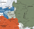
 CongressPoland1914Map.png 2,125 × 2,524; 1.13 MB
-
 CongressPoland1914MapPOL.png 2,125 × 2,524; 1.15 MB
-
 CongressPoland1914MapRUS.png 2,125 × 2,524; 1.19 MB
-
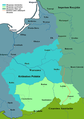
 Gubernia chełmska.png 198 × 240; 3 KB
-
 Gubernia radomska.jpg 350 × 340; 61 KB
-
 Karte kongresspolen.png 896 × 766; 602 KB
-
 KholmGovernorate1913Map.png 633 × 1,058; 144 KB
-
 KingdomofPoland1815 hu.svg 1,133 × 851; 611 KB
-
 KingdomofPoland1815.jpg 592 × 444; 261 KB
-
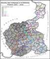 Kolej w Kongresówce 1842-1918.png 1,187 × 1,403; 359 KB
-
 KP gubernia kaliska 1910.svg 750 × 935; 44 KB
-
 KP gubernia kielecka 1910.svg 750 × 935; 44 KB
-
 KP gubernia lubelska 1910.svg 750 × 935; 43 KB
-
 KP gubernia piotrkowska 1910.svg 750 × 935; 44 KB
-
 KP gubernia płocka 1910.svg 750 × 935; 44 KB
-
 KP gubernia radomska 1910.svg 750 × 935; 44 KB
-
 KP gubernia siedlecka 1910.svg 750 × 935; 43 KB
-
 KP gubernia suwalska 1910.svg 750 × 935; 44 KB
-
 KP gubernia warszawska 1910.svg 750 × 935; 44 KB
-
 KP gubernia łomżyńska 1910.svg 750 × 935; 44 KB
-
 Legiony 1914-1916.png 1,653 × 2,232; 899 KB
-
 Map of Congress Poland, 1835.gif 1,522 × 1,988; 1.05 MB
-

-
 OkupacjaKP1914-18-es.svg 1,494 × 2,124; 458 KB
-
 OkupacjaKP1914-18.PNG 1,594 × 2,266; 221 KB
-
 Poland1815.jpg 600 × 452; 323 KB
-
 Polska 1907 adm-light-frame.png 1,187 × 1,403; 1.11 MB
-
 Polska 1907 adm.png 1,183 × 1,399; 1.11 MB
-
 Rzeczpospolitapodrozb.png 700 × 600; 247 KB
-
 Territorial changes of Poland 1815.jpg 850 × 700; 178 KB
-
 Territorial changes of Poland 1831.jpg 850 × 700; 174 KB
-
 Territorial changes of Poland 1846.jpg 850 × 700; 166 KB
-
 Territorial changes of Poland 1848.jpg 850 × 700; 156 KB
-
 Territorial changes of Poland 1862.jpg 850 × 700; 143 KB
-
 Territorial changes of Poland 1867.jpg 850 × 700; 139 KB
-
 Tsardom of Poland (1815).svg 450 × 456; 654 KB
.png)


.svg)