Category:Maps of the British Antarctic Territory
Jump to navigation
Jump to search
Subcategories
This category has the following 6 subcategories, out of 6 total.
G
M
P
Media in category "Maps of the British Antarctic Territory"
The following 50 files are in this category, out of 50 total.
-
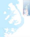 Alexander Island Group, British Antarctic Territory.svg 1,457 × 1,762; 3.61 MB
-
 Antarctica, United Kingdom territorial claim.svg 806 × 806; 63 KB
-
 Antarktyda-Brytyjskie Terytorium Antarktyczne.png 1,967 × 1,505; 80 KB
-
 BAT map.jpg 247 × 207; 7 KB
-
 Bellingshausen Sea shaded, with the BAT.svg 486 × 484; 4.77 MB
-
 Berkner Island - Weddell Sea, BAT.svg 3,118 × 2,437; 3 MB
-
 Berkner Island in the British Antarctic Territory B.svg 619 × 619; 1.15 MB
-
 Berkner Island within the British Antarctic Territory.svg 654 × 776; 768 KB
-
 Biscoe Islands, BAT.svg 318 × 356; 1.11 MB
-
 Black Coast.svg 1,018 × 917; 4.52 MB
-
 Bowman Coast.svg 1,018 × 917; 4.52 MB
-
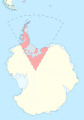
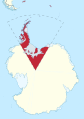
 British Antarctic Territory (in Antarctica).svg 907 × 906; 4.53 MB
-
 British Antarctic Territory map.svg 438 × 416; 4.53 MB
-
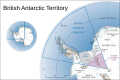
 British Antarctic Territory pink.svg 900 × 1,280; 1.16 MB
-
 British Antarctic Territory top.svg 900 × 1,280; 1.04 MB
-
 BritishAntarcticTerritory.svg 960 × 640; 100 KB
-
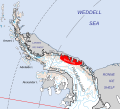
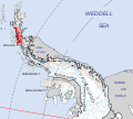
 Caird Coast.svg 1,387 × 1,023; 4.52 MB
-
 Chile, Argentina, UK Antarctica.png 1,021 × 1,022; 762 KB
-
 Map of Coats Land, BAT.svg 486 × 484; 4.56 MB
-
 Danco Coast.svg 1,018 × 917; 4.51 MB
-
 Davis Coast.svg 1,018 × 917; 4.51 MB
-
 Doake Ice Rumples - Weddell Sea, BAT.svg 3,118 × 2,437; 3 MB
-
 English Coast.svg 1,018 × 917; 4.51 MB
-
 Falkland-islands-dependencies-map-rus.jpg 663 × 809; 417 KB
-
 Fallières Coast.svg 1,018 × 917; 4.52 MB
-
 Foyn Coast.svg 1,018 × 917; 4.51 MB
-
 Graham Coast.svg 1,018 × 917; 4.51 MB
-
 GrahamLandstubmap.png 243 × 334; 30 KB
-
 Hemmen Ice Rise - Weddell Sea, BAT.svg 3,118 × 2,437; 3 MB
-
 Henry Ice Rise - Weddell Sea, BAT.svg 3,118 × 2,437; 3 MB
-
 Ice shelf islands, British Antarctic Territory.svg 3,118 × 2,437; 3 MB
-
 Kershaw Ice Rumples - Weddell Sea, BAT.svg 3,118 × 2,437; 3 MB
-
 Korff Ice Rise - Weddell Sea, BAT.svg 3,118 × 2,437; 3 MB
-
 Lassiter Coast.svg 1,018 × 917; 4.52 MB
-
 Location map of the South Shetland islands, BAT.svg 486 × 484; 4.56 MB
-
 Loubet Coast, Graham Land.svg 1,018 × 917; 4.51 MB
-
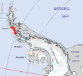
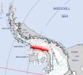
 Luitpold Coast.svg 1,387 × 1,023; 4.52 MB
-
 Map of Queen Elizabeth Land & BAT in Antarctica.svg 907 × 906; 4.56 MB
-
 Map of Queen Elizabeth Land, BAT.svg 486 × 484; 4.56 MB
-
 Nordenskjöld Coast.svg 1,018 × 917; 4.51 MB
-
 Orville Coast.svg 1,018 × 917; 4.52 MB
-
 Oscar II Coast.svg 1,018 × 917; 4.51 MB
-
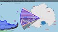
 Overlapping Antarctic land claims (focus on Argentina, Chile, & UK).svg 705 × 395; 46.01 MB
-
 Overlapping Antarctic land claims (focusing on Argentina, Chile, & UK).pdf 1,468 × 822; 20.13 MB
-
 Palmer Archipelago location in Graham Land, BAT.svg 1,282 × 1,662; 3.99 MB
-
 Robertson Island location in Graham Land, BAT.svg 1,282 × 1,662; 3.99 MB
-
 Rymill Coast.svg 1,018 × 917; 4.51 MB
-
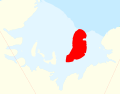
 Trinity Peninsula.svg 1,018 × 917; 4.51 MB
-
 Wilkins Coast.svg 1,018 × 917; 4.51 MB
-
 Zumberge Coast.svg 1,095 × 1,074; 4.52 MB


.svg)


.svg)


