Category:Maps of the Borough of South Ribble
Jump to navigation
Jump to search
Media in category "Maps of the Borough of South Ribble"
The following 22 files are in this category, out of 22 total.
-
 Bamber Bridge unparished area UK locator map.svg 1,425 × 1,038; 355 KB
-
 Borough of South Ribble parishes map.svg 1,425 × 1,038; 3.62 MB
-
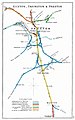 Euxton, Farington & Preston RJD 62.jpg 1,668 × 2,664; 585 KB
-
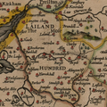 Hundred of Leyland.png 915 × 915; 1.43 MB
-
 LancashireSouthRibble.png 200 × 250; 19 KB
-
 Lancaster Canal Tramroad map.svg 490 × 662; 1.74 MB
-
 Leyland unparished area UK locator map.svg 1,425 × 1,038; 355 KB
-
 Location map United Kingdom Borough of South Ribble 2020.svg 1,425 × 1,038; 5.64 MB
-
 Location map United Kingdom Borough of South Ribble.svg 1,425 × 1,038; 11.51 MB
-
 PR postcode area locator map.png 644 × 702; 74 KB
-
 PR postcode area.png 636 × 693; 92 KB
-
 PRESTON (post town) locator map.png 644 × 703; 76 KB
-
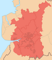 Preston Travel to Work Area 2007.png 602 × 696; 72 KB
-
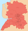
 Preston Urban Area locator map.png 643 × 703; 65 KB
-
 Preston Urban Area within Central Lancashire.png 469 × 712; 70 KB
-
 South Ribble UK local election 2003 map.svg 1,425 × 1,038; 403 KB
-
 South Ribble UK local election 2007 map.svg 1,425 × 1,038; 402 KB
-
 South Ribble UK local election 2011 map.svg 1,425 × 1,038; 402 KB
-
 South Ribble UK locator map.svg 1,116 × 1,305; 1.25 MB
-
 South Ribble UK ward map 2010 (blank).svg 1,425 × 1,038; 401 KB
-
 South Ribble UK ward map 2015 (blank).svg 1,425 × 1,038; 514 KB
-
 South Ribble UK ward map 2023.svg 1,425 × 1,038; 378 KB


_locator_map.png)


.svg)
.svg)