Category:Maps of the Borough of Christchurch
Jump to navigation
Jump to search
English: Maps of the former Christchurch district, now in Bournemouth, Christchurch and Poole district, in the ceremonial county of Dorset, England.
Media in category "Maps of the Borough of Christchurch"
The following 8 files are in this category, out of 8 total.
-
 20200421163557!Christchurch UK locator map.svg 1,425 × 990; 997 KB
-
 Christchurch UK local election 2003 map.svg 1,385 × 1,226; 234 KB
-
 Christchurch UK local election 2007 map.svg 1,385 × 1,226; 234 KB
-
 Christchurch UK local election 2011 map.svg 1,385 × 1,226; 234 KB
-
 Christchurch UK local election 2015 map.svg 1,385 × 1,226; 234 KB
-
 Christchurch UK locator map.svg 1,425 × 990; 929 KB
-
 Christchurch UK ward map 2010 (blank).svg 1,385 × 1,226; 234 KB
-
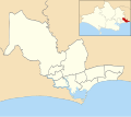
 DorsetChristchurch.png 200 × 148; 5 KB


.svg)