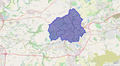
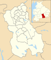
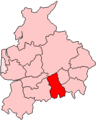
Category:Maps of the Borough of Blackburn with Darwen
Jump to navigation
Jump to search
Wikimedia category | |||||
| Upload media | |||||
| Instance of | |||||
|---|---|---|---|---|---|
| Category combines topics | |||||
| Blackburn with Darwen | |||||
unitary authority area in Lancashire, North West England  | |||||
| Instance of | |||||
| Location | Lancashire, North West England, England | ||||
| Capital | |||||
| Legislative body |
| ||||
| Headquarters location | |||||
| Inception |
| ||||
| Population |
| ||||
| Area |
| ||||
| official website | |||||
 | |||||
Media in category "Maps of the Borough of Blackburn with Darwen"
The following 16 files are in this category, out of 16 total.
-
 Blackburn & Darwen extent of Coronavirus restrictions from 22-8-20.png 2,681 × 1,467; 3.4 MB
-
 CorporationParkMap.png 538 × 630; 121 KB
-
 CorporationParkPlans1854.JPG 1,508 × 1,766; 1.08 MB
-
 Blackburn unparished area UK locator map.svg 1,099 × 1,305; 291 KB
-
 Blackburn with Darwen parishes map.svg 1,099 × 1,305; 2.54 MB
-
 Blackburn with Darwen UK locator map.svg 1,116 × 1,305; 1.25 MB
-
 Blackburn with Darwen UK ward map 2010 (blank).svg 1,099 × 1,305; 345 KB
-
 Blackburn with Darwen UK ward map 2023.svg 528 × 731; 206 KB
-
 Blackburn with Darwen UK ward map 2024.svg 563 × 779; 206 KB
-
 BLACKBURN-WITH-DARWEN (49910224268).png 2,160 × 1,080; 351 KB
-
 EnglandBlackburnDarwen.png 200 × 247; 25 KB
-
 Hoddlesden unparished area UK locator map.svg 1,099 × 1,305; 291 KB
-
 LancashireBlackburn.png 200 × 250; 3 KB
-
 Location map United Kingdom Blackburn central.svg 1,093 × 924; 2.12 MB
-
 Location map United Kingdom Blackburn with Darwen.svg 1,099 × 1,305; 3.32 MB
-
 Location map United Kingdom Blackburn.svg 360 × 373; 1.27 MB


.png)


.svg)