Category:Maps of the Bay of Gibraltar
Jump to navigation
Jump to search
Subcategories
This category has the following 2 subcategories, out of 2 total.
Media in category "Maps of the Bay of Gibraltar"
The following 86 files are in this category, out of 86 total.
-
-

-
 Admiralty Chart No 1448 Acebuche Point to Chullera Point, Published 1906.jpg 11,067 × 16,223; 36.71 MB
-
 Admiralty Chart No 1448 Gibraltar Bay, Published 1968.jpg 11,336 × 16,443; 41.53 MB
-
 Algeciras 1801 english.png 1,000 × 1,154; 1.35 MB
-
 Algeciras 1801 español batalla.jpg 741 × 772; 132 KB
-
 Algeciras 1801 español.png 1,000 × 1,154; 1.35 MB
-
 Algeciras Arabe grande6.jpg 1,400 × 731; 168 KB
-
 Algeciras costa.jpg 1,765 × 2,167; 411 KB
-
 Algeciras fuertes grande.jpg 1,462 × 836; 178 KB
-
 Algeciras Sitio de Alfonso XI.jpg 1,750 × 979; 334 KB
-
 Algeciras Villa Vieja Campamento-ar.jpg 1,000 × 938; 259 KB
-
 Algeciras Villa Vieja Campamento.jpg 1,000 × 938; 307 KB
-
 AlgecirasArabe2.jpg 1,000 × 938; 326 KB
-
 Bahia Algeciras costa.png 1,184 × 1,173; 197 KB
-
 Bahia Algeciras relieve.png 1,184 × 1,173; 298 KB
-
 Bahia de Algeciras fuertes costeros.png 1,500 × 1,895; 621 KB
-
 Bahia de Algeciras fuertes2.jpg 1,000 × 1,157; 205 KB
-
 Bahia de Algeciras proteccion.png 1,184 × 1,173; 202 KB
-
 Bahia de Algeciras torres de vigilancia.png 1,500 × 1,895; 727 KB
-
 Bahia geologico.png 1,184 × 1,173; 151 KB
-
 Bahia paleolitico.png 1,184 × 1,173; 756 KB
-
 Bahia rios.png 1,184 × 1,173; 199 KB
-
 Bahia siglo I.png 1,184 × 1,173; 782 KB
-
 Bahia siglo XIII.png 1,184 × 1,173; 769 KB
-
 Bahia siglo XVIII.png 1,184 × 1,173; 793 KB
-
 Bahia urbano.png 1,184 × 1,173; 194 KB
-
 Bahía Algeciras.jpg 1,565 × 2,330; 1.03 MB
-
 Bahía de Algeciras búnkers.png 1,500 × 1,895; 734 KB
-
 Bahía de Algeciras fortificaciones XVIII.png 1,500 × 1,895; 923 KB
-
 Bahía de Algeciras mapa limpio.jpg 1,540 × 1,935; 1.52 MB
-
 Bahía de Algeciras paleolitico.png 1,500 × 1,895; 761 KB
-
 Bahía de Algeciras siglo IV.png 1,500 × 1,895; 714 KB
-
 Bahía de Algeciras siglo IX.jpg 1,540 × 1,935; 1.74 MB
-
 Bahía de Algeciras siglo XIII.png 1,500 × 1,895; 690 KB
-
 Bahía de Algeciras siglo XVIII.png 1,500 × 1,895; 682 KB
-
 Bahía de Algeciras Toma de Gibraltar 1704.png 1,500 × 1,895; 542 KB
-
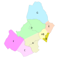
 Bay of Gibraltar map.png 502 × 357; 30 KB
-
 Baye de Gibraltar - btv1b84938697.jpg 9,600 × 7,706; 7.08 MB
-
 Bunkers en los alrededores de la bahía de Algeciras.jpg 500 × 712; 83 KB
-

-
 Campo de Gibraltar carreteras.png 2,187 × 2,396; 2.84 MB
-
 Campo de Gibraltar completo.png 2,187 × 2,693; 4.08 MB
-
 Campo de Gibraltar Urbano.png 2,187 × 2,396; 3.24 MB
-
 Carta de la bahia de Gibraltar - por Don Tomas López... - btv1b532270197 (1 of 2).jpg 7,746 × 5,912; 4.86 MB
-
 Carte de la baie de Gibraltar. - btv1b84431347.jpg 10,585 × 8,040; 8.86 MB
-

-
 Carte de la baye de Gibraltar (1762).jpg 3,000 × 2,133; 1.78 MB
-
 Carte de la Baye de Gibraltar - btv1b530563592.jpg 2,944 × 3,472; 1.45 MB
-

-
 CTMCG-zonas-bahía.png 1,180 × 890; 99 KB
-
 CTMCG-zonas.png 1,000 × 750; 102 KB
-
 CTMCG-zonas.svg 400 × 400; 27 KB
-
 De Baay en Stadt van Gibraltar - btv1b53029637k.jpg 9,407 × 7,618; 10.76 MB
-

-

-
 Defensas de gibraltar 1704.jpg 2,189 × 2,386; 2.05 MB
-
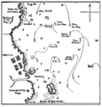 First Battle of Algeciras map.png 1,452 × 1,516; 100 KB
-
 Fuerte punta carnero.jpg 2,000 × 2,554; 397 KB
-
 Fuertes de la linea3.jpg 1,158 × 572; 185 KB
-
 Fuertes.jpg 900 × 830; 131 KB
-
 Gibraltar and Bay map 1750.jpg 2,049 × 2,750; 877 KB
-

-
 Gibraltar, avec les nouveaux ouvrages faits depuis le dernier siège... - btv1b53027968q.jpg 8,385 × 6,340; 10.76 MB
-

-
 Linea de contravalacion.jpg 2,000 × 2,132; 233 KB
-
 Lines of contravallation of Gibraltar.png 2,000 × 2,132; 333 KB
-
 Map of Gibratar, 1782.jpg 1,674 × 3,161; 787 KB
-
 Mapa mudo del Campo de Gibraltar (gris).jpg 926 × 1,042; 52 KB
-
 Nouveau plan de Gibraltar - Jean Covens et Corneille Mortier.jpg 1,276 × 1,107; 759 KB
-
 Nouveau plan de la ville de Gibraltar, située au détroit de ce nom... - btv1b8444206k.jpg 9,195 × 7,504; 10.98 MB
-
 Openstreetmap map of GibraltarpediA related articles.jpg 801 × 675; 119 KB
-

-

-

-

-
 Plan de la ville et des forts de Gibraltar, avec la baye d'Algesiras - btv1b53227065h (1 of 2).jpg 12,294 × 8,462; 13.87 MB
-

-

-
 Puerto de La Línea de la Concepción 2018.png 3,000 × 2,000; 1.03 MB
-
 Puerto de La Línea.jpg 900 × 752; 380 KB
-
 San Roque Barriadas-zonas.png 900 × 866; 98 KB
-

-
 The Harbor and Strait of Gibraltar - Johannes Covens en Cornelis Mortier.jpg 1,276 × 1,076; 777 KB
-
 Toma de Gibraltar.jpg 700 × 810; 95 KB
-
 Yacimientos romanos de Algeciras.png 1,500 × 1,895; 818 KB
.jpg)
_-_btv1b84392182.jpg)


.jpg)


.jpg)

_C(oquart)_-_btv1b530562011.jpg)


_(14760895671).jpg)


.jpg)


.jpg)
_;_par_le_Sr._de_Vezou..._-_btv1b8491996v.jpg)
.jpg)


