Category:Maps of the Battle of Rossbach
Jump to navigation
Jump to search
Media in category "Maps of the Battle of Rossbach"
The following 19 files are in this category, out of 19 total.
-
 Bataille de Rossbach le 5 novembre 1757 - btv1b8440065h.jpg 5,125 × 4,490; 2.85 MB
-
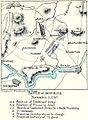
 Battle of Rossbach - Maneuver for position, 2-4 November 1757.png 925 × 720; 103 KB
-
 Battle of rossbach wide.jpg 447 × 608; 336 KB
-
 Battle rossbach trap.png 921 × 716; 104 KB
-
 EB1911 Rossbach.png 1,062 × 1,139; 618 KB
-
 Meyers b13 s0978 b1.png 385 × 343; 62 KB
-
 MeyersRossbach.jpg 363 × 323; 46 KB
-
 Rossbach map positioning.jpg 925 × 720; 455 KB
-
 Rossbach-leuthen-giu-ott.png 2,754 × 1,829; 721 KB
-
 Rossbach-leuthen-giu-sett.jpg 8,041 × 4,469; 1.33 MB
-
 Rossbach-leuthen-nov-dic.png 2,754 × 1,829; 754 KB
-
 Rossbach-leuthen-ott.png 2,754 × 1,829; 704 KB
-
 Rossbach-leuthen.svg 1,052 × 744; 660 KB
-
 Schlacht bei grossjagersdorf.jpg 492 × 396; 28 KB
-
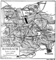
 Schlacht bei Rosbach-A.jpg 999 × 641; 617 KB
-
 Schlacht bei Rosbach-B.jpg 747 × 659; 344 KB
-
 Schlacht bei Rosbach-C.jpg 1,009 × 719; 900 KB
-
 Spruner-Menke Handatlas 1880 Karte 46 Nebenkarte 13.jpg 875 × 1,145; 98 KB
-
 Umgebungskarte Rossbach 5 November 1757.jpg 1,307 × 1,038; 375 KB


