Category:Maps of the Battle of Okinawa
Jump to navigation
Jump to search
English: Category for the maps of the Battle of Okinawa
日本語: 沖縄戦に関する地図のカテゴリ
Media in category "Maps of the Battle of Okinawa"
The following 54 files are in this category, out of 54 total.
-
 1944 Okinawa Enemy Dispositions (30249095573).jpg 6,479 × 5,312; 2.36 MB
-
 1945-04-01JapOKWW2BattlefrontAtlas.jpg 578 × 573; 281 KB
-
 1945-04-15JapOKWW2BattlefrontAtlas.jpg 584 × 583; 311 KB
-
 1945-05-01JapOKWW2BattlefrontAtlas.jpg 585 × 588; 348 KB
-
 1945-05-15JapOKWW2BattlefrontAtlas.jpg 582 × 585; 364 KB
-
 1945-06-01JapOKWW2BattlefrontAtlas.jpg 577 × 581; 308 KB
-
 1945-06-15JapOKWW2BattlefrontAtlas.jpg 583 × 582; 353 KB
-
 6th marines advance.jpg 1,100 × 1,149; 549 KB
-
 Battle of Okinawa Japanese Dispositions.jpg 597 × 922; 73 KB
-
 Battle of Okinawa Northern Operation.jpg 599 × 921; 103 KB
-
 Battle of Okinawa-ar.png 800 × 566; 56 KB
-
 Battle of Okinawa.svg 1,052 × 744; 79 KB
-
 Battlefield Composite Map of Okinawa.jpg 23,952 × 46,337; 255.53 MB
-
 Desant na Okinawe-mapa.png 863 × 721; 280 KB
-
 Hagushi landing.jpg 640 × 926; 142 KB
-
 Ie defence positions.png 1,217 × 724; 803 KB
-
 Ie Shima assault.jpg 800 × 1,103; 175 KB
-
 Invasion of Ie Shima - NARA - 100307404.jpg 6,400 × 5,053; 1.07 MB
-
 Invasion of okinawa 1.jpg 1,260 × 970; 179 KB
-
 Invasionof okinawa 2.jpg 1,260 × 970; 273 KB
-
 Jamato - poslední plavba.png 771 × 862; 212 KB
-
 Kerama island landing map.jpg 800 × 1,132; 157 KB
-
 Map of Battle for Sugar Loaf Hill.jpg 1,700 × 1,326; 534 KB
-
 Map of Western Okinawa Beaches - NARA - 100307410.jpg 10,272 × 13,283; 6.98 MB
-
 Motobu peninsula 1.jpg 800 × 614; 144 KB
-
 Motobu peninsula 2.jpg 800 × 618; 133 KB
-
 Motobu peninsula 3.jpg 800 × 617; 121 KB
-
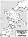 Okinawa advance april 5.jpg 640 × 835; 122 KB
-
 Okinawa airfields 1945.jpg 785 × 600; 104 KB
-
 Okinawa Invasion Beaches, 1 April 1945 - Map.jpg 1,200 × 1,712; 349 KB
-
 Okinawa Invasion Map.jpg 268 × 375; 35 KB
-
 OKINAWA UDT-7 MAP Yellow Beaches.jpg 2,625 × 2,000; 745 KB
-
 Okinawa, April-June 1945-49b - Naha-Shuri-Yonabaru.png 623 × 953; 378 KB
-
 Okinawa, Initial Attack;ch1p11.jpg 587 × 819; 136 KB
-
 Okinawa.jpg 800 × 919; 132 KB
-
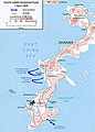
 Operation Iceberg - Kerama Retto - 1945.jpg 800 × 502; 75 KB
-
 Operation Iceberg.jpg 1,260 × 970; 162 KB
-
 Operations Chart - Action Report Iheya-Aguni Operation.jpg 7,266 × 6,338; 6.33 MB
-
 Ten-Go-DE.svg 378 × 436; 103 KB
-
 Ten-Go-RU.svg 378 × 436; 99 KB
-
 Ten-Go2.png 402 × 436; 131 KB
-
 Ten-goMap-fr.svg 714 × 654; 88 KB
-
 Ten-goMap-ja.svg 714 × 654; 170 KB
-
 Ten-goMap1.png 229 × 208; 10 KB
-
 The Last Sortie of Yamato - track via USSBS-ar.jpg 1,024 × 1,144; 357 KB
-
 The Last Sortie of Yamato - track via USSBS.jpg 1,024 × 1,144; 207 KB
-
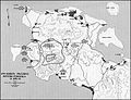
 Thirty Second Army Troop Dispositions - NARA - 100307406.jpg 6,464 × 8,967; 2.08 MB
-
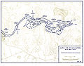
 Through the Outposts- XXIV Corps, 4-8 April 1945.jpg 1,024 × 707; 258 KB
-
 US Map Okinawa The Pinnacle.jpg 800 × 994; 249 KB
-
 US Navy Battle of Okinawa radar picket stations 1945.jpg 913 × 702; 318 KB
-
 XXXIV Corps Advance Checked - NARA - 100307408.jpg 14,240 × 6,421; 3.64 MB
-
 旧日本軍が建設した飛行場.png 760 × 902; 106 KB
-
 米軍が設置した収容所.png 639 × 768; 116 KB
-
 米軍が設置した飛行場.png 620 × 671; 98 KB
.jpg)


