Category:Maps of the Argonauts' travel
Jump to navigation
Jump to search
Media in category "Maps of the Argonauts' travel"
The following 17 files are in this category, out of 17 total.
-
 Argonautica 1645 Kaerius Janß suae 74 copy.jpg 944 × 755; 188 KB
-
 Argonautica 1645 Kaerius Janß².jpg 2,760 × 2,114; 1.81 MB
-
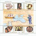 Argonauts Georgia 1988.jpg 744 × 750; 57 KB
-
 Argonauts path Carli.jpg 1,125 × 620; 240 KB
-
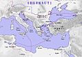
 Ge colxida.png 312 × 250; 14 KB
-
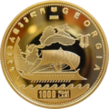 GE-2006-1000lari-Fleece-a.png 414 × 415; 274 KB
-
 GE-2006-10lari-Fleece-a.png 364 × 367; 279 KB
-
 GE-2006-25lari-Fleece-a.png 363 × 366; 275 KB
-
 GE-2006-300lari-Fleece-a.png 414 × 417; 275 KB
-
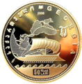 GE-2006-50lari-Fleece-a.png 363 × 368; 277 KB
-
 MapoftheVoyageoftheArgonauts Black Sea.jpg 1,258 × 991; 1.45 MB
-
 MapoftheVoyageoftheArgonauts Caucasus.jpg 712 × 561; 502 KB
-
 MapoftheVoyageoftheArgonauts.jpg 3,188 × 2,278; 11.02 MB
-
 Maps of the Argonautica by Abraham Ortelius.jpeg 3,043 × 2,352; 2.27 MB
-
 MS-Argonautai-route-revised.jpg 1,000 × 700; 183 KB
-
 MS-Argonautai-route.jpg 1,000 × 700; 156 KB
-
 Viaggio argonauti.JPG 1,000 × 700; 135 KB


