Category:Maps of the Altmühl watercourse system
Jump to navigation
Jump to search
Media in category "Maps of the Altmühl watercourse system"
The following 10 files are in this category, out of 10 total.
-
 Altmuehl2.png 812 × 864; 523 KB
-
 Altmühl.png 831 × 886; 1.96 MB
-
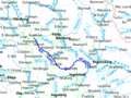
 Karte Altmyhl.gif 419 × 379; 19 KB
-
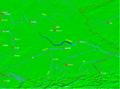 Lage altmyhl.png 1,066 × 788; 169 KB
-
 Lage fluss altmühl.PNG 1,066 × 788; 536 KB
-
 Altmuehl catchment.png 1,200 × 731; 1.62 MB
-
 Altmuehl.png 829 × 915; 1.42 MB
-
 Altmyhl2.png 508 × 382; 35 KB
-
 Philipp Apian - Bairische Landtafeln von 1568 - Tafel 09 Eichstätt Ingolstadt.jpg 3,584 × 2,909; 2.87 MB
-
 Philipp Apian - Bairische Landtafeln von 1568 - Tafel 10 Ingolstadt Kehlheim.jpg 3,386 × 2,520; 2.5 MB


